Maverick County Memorial International Airport
| Maverick County Memorial International Airport | |||||||||||
|---|---|---|---|---|---|---|---|---|---|---|---|
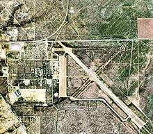 USGS aerial photo, 2006 | |||||||||||
| Summary | |||||||||||
| Airport type | Public | ||||||||||
| Owner | County of Maverick | ||||||||||
| Serves | Eagle Pass, Texas | ||||||||||
| Location | Radar Base, Maverick County, near Eagle Pass, Texas | ||||||||||
| Elevation AMSL | 887 ft / 270 m | ||||||||||
| Coordinates | 28°51′26″N 100°30′48″W / 28.85722°N 100.51333°WCoordinates: 28°51′26″N 100°30′48″W / 28.85722°N 100.51333°W | ||||||||||
| Map | |||||||||||
 5T9 | |||||||||||
| Runways | |||||||||||
| |||||||||||
| Statistics (2008) | |||||||||||
| |||||||||||
- For the military use of the airport, see Eagle Pass Army Airfield
Maverick County Memorial International Airport (IATA: EGP, FAA LID: 5T9) is a county-owned public use airport in Maverick County, Texas, United States. It is located eight nautical miles (15 km) north of the central business district of Eagle Pass, Texas.[1]
Facilities and aircraft
Maverick County Memorial International Airport has one asphalt paved runway designated 13/31 which measures 5,506 by 100 feet (1,678 x 30 m). For the 12-month period ending July 28, 2008, the airport had 600 general aviation aircraft operations, an average of 50 per month.[1]
References
External links
- FAA Terminal Procedures for 5T9, effective October 11, 2018
- Resources for this airport:
- FAA airport information for 5T9
- AirNav airport information for 5T9
- ASN accident history for EGP
- FlightAware airport information and live flight tracker
- SkyVector aeronautical chart for 5T9
This article is issued from
Wikipedia.
The text is licensed under Creative Commons - Attribution - Sharealike.
Additional terms may apply for the media files.