Matlock, Washington
| Matlock | |
|---|---|
| Unincorporated community | |
 Matlock  Matlock | |
| Coordinates: 47°14′18″N 123°24′28″W / 47.23833°N 123.40778°WCoordinates: 47°14′18″N 123°24′28″W / 47.23833°N 123.40778°W | |
| Country | United States |
| State | Washington |
| County | Mason |
| Area | |
| • Total | 21.6615 sq mi (56.103 km2) |
| • Land | 21.6557 sq mi (56.088 km2) |
| • Water | 0.0058 sq mi (0.015 km2) |
| Population (2000) | |
| • Total | 155 |
| Time zone | UTC-8 (Pacific (PST)) |
| • Summer (DST) | UTC-7 (PDT) |
| ZIP code | 98560 |
| Area code(s) | 360 |
Matlock is an unincorporated community in Mason County, Washington, United States.[1] Matlock is the primary population center for the western part of Mason County, a sporadically populated logging area. The most notable sites are the church, food bank, general store, post office, local grange hall, and the Mary M. Knight school, grades kindergarten through senior high school; the school mascot is the Knight Owl.
Matlock features nearby lakes and recreational opportunities, including fishing, hiking, hunting, and horseback riding. The nearest lake to Matlock is Lake Nahwatzel. Every year during the first full weekend in May, Matlock hosts the Old Timers' Fair at Mary M. Knight School campus. The fair features food, crafts, tractors, and fun for the whole family. Matlock is located northwest of Olympia, Washington, about a 20-minute drive from the county seat, Shelton. Matlock is a secluded little town just outside of Shelton and Elma. Matlock is also home to Mason County Fire District 12.
Climate
Matlock has high annual precipitation 87 inches (220 cm) due to strong influence from the nearby Pacific. A significant drying trend occurs in summer, giving Matlock a warm-summer Mediterranean climate (Csb) according to the Köppen climate classification system.
| Climate data for Matlock | |||||||||||||
|---|---|---|---|---|---|---|---|---|---|---|---|---|---|
| Month | Jan | Feb | Mar | Apr | May | Jun | Jul | Aug | Sep | Oct | Nov | Dec | Year |
| Record high °F (°C) | 57 (14) |
60 (16) |
61 (16) |
77 (25) |
89 (32) |
84 (29) |
89 (32) |
97 (36) |
92 (33) |
76 (24) |
58 (14) |
55 (13) |
97 (36) |
| Average high °F (°C) | 45.4 (7.4) |
47.1 (8.4) |
49.7 (9.8) |
55.4 (13) |
63 (17) |
67.3 (19.6) |
73.6 (23.1) |
77.3 (25.2) |
74.6 (23.7) |
59.3 (15.2) |
49.2 (9.6) |
44.5 (6.9) |
58.9 (14.9) |
| Average low °F (°C) | 33 (1) |
33 (1) |
35.7 (2.1) |
36.8 (2.7) |
40.8 (4.9) |
46.7 (8.2) |
50.2 (10.1) |
50 (10) |
45 (7) |
41.5 (5.3) |
32.7 (0.4) |
32 (0) |
39.8 (4.3) |
| Record low °F (°C) | 21 (−6) |
18 (−8) |
21 (−6) |
27 (−3) |
30 (−1) |
37 (3) |
40 (4) |
38 (3) |
32 (0) |
28 (−2) |
23 (−5) |
21 (−6) |
18 (−8) |
| Average precipitation inches (mm) | 14.39 (365.5) |
8.78 (223) |
9.75 (247.7) |
6.43 (163.3) |
4.3 (109) |
2.49 (63.2) |
1.27 (32.3) |
1.61 (40.9) |
2.61 (66.3) |
8.37 (212.6) |
13.96 (354.6) |
13.04 (331.2) |
87 (2,210) |
| Average snowfall inches (cm) | 1.4 (3.6) |
1 (3) |
0.5 (1.3) |
0 (0) |
0 (0) |
0 (0) |
0 (0) |
0 (0) |
0 (0) |
0 (0) |
0.8 (2) |
0.1 (0.3) |
3.7 (9.4) |
| Average precipitation days | 22 | 17 | 21 | 18 | 14 | 12 | 7 | 7 | 9 | 16 | 21 | 21 | 185 |
| Source: [2] | |||||||||||||
References
- ↑ "Matlock". Geographic Names Information System. United States Geological Survey.
- ↑ "MATLOCK 8 S, WASHINGTON (455086)". Western Regional Climate Center. Retrieved November 18, 2015.
External links
- Matlock page of official Mason County Tourism website
Municipalities and communities of Mason County, Washington, United States | ||
|---|---|---|
| City | 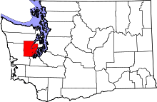 | |
| CDPs | ||
| Other unincorporated communities | ||
| Ghost town | ||
| Indian reservations | ||