Matlab (Bangladesh)
| Matlab | |
|---|---|
 Location in Bangladesh | |
| Coordinates: 23°21′N 90°42.5′E / 23.350°N 90.7083°ECoordinates: 23°21′N 90°42.5′E / 23.350°N 90.7083°E | |
| Country |
|
| Division | Chittagong Division |
| District | Chandpur District |
| Time zone | UTC+6 (BST) |
Matlab was an Upazila (subdistrict) of Chandpur District in the Division of Chittagong, Bangladesh.[1] In 2000, the administrative area was subdivided into Matlab Dakshin Upazila and Matlab Uttar Upazila.[1]
Matlab Health and Demographic Surveillance Site (HDSS) was established in 1963 by the Pakistan-SEATO Cholera Research Laboratory (PSCRL). The Matlab population is the largest population under continuous surveillance in the world. The area is typical to many many rural and riverine deltas of Bangladesh. Matlab, a rural area, about 50 km south of Dhaka is one of the richest and longest running longitudinal data source of developing world.[2] In 1960, a group of American and Bangladeshi scientists started drifting around a cholera-prone sub-district of Bangladesh boarded on a barge turned floating cholera hospital. The barge used to float around Matlab with scientists and doctors to treat the patients with cholera from remote places. This is the commencing story of Matlab HDSS which would develop into the Matlab Health Research Centre- a full-fledged health care facility and one of the most important research sites in the world.
In 1966, a Health and Demographic Surveillance System (HDSS) was established in Matlab to record data regarding birth, death and migration. Initially the main purpose was to conduct cholera vaccine trials and to track the trends of public health problems of rural Bangladesh. One of the most important role Matlab played in the field of public health is development of an Oral Rehydration Solution (ORS). It was a cheap drinking solution made from salt, molasses and water. In 1968 it was first trialed at Matlab. It is considered as one of the most important medical advance of 20th century and estimated to have saved around 50 million lives globally.[3]
Geography
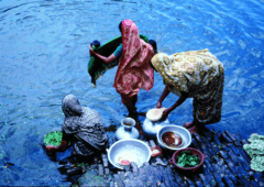
Matlab is a thana of Chadpur district of Bangladesh. It is situated 55 km southeast of Dhaka, which is country’s capital at 23.38 degree North latitude and 90.72 degree longitude. The total HDSS area is 184 km2. Three seasons can be seen- monsoon, cool-dry and hot-dry with a sub-tropical climate. It is subject annual flooding due to low-lying flat lands and crossing over many rivers and canal. Average annual rainfall is about 2159 mm which is concentrated mainly during monsoon (June to September).[4]
Inception, structure and procedure
At the onset, 132 villages were included and 101 villages were added in 1968. The Traditional Birth Attendants (dais, elderly illiterate women mostly) used to work to detect and record data of the vital events through weekly household visit. The Health Assistants (HA) along with the Dais visited the households every six weeks with standard registration form. In 1977 major modification on field structure and programme activities were made, with exclusion of 84 villages and 149 villages were retained. Family Planning and Health Services Project was then launched in 70 villages and remaining 79 villages were considered as Comparison area. All Dais of treatment and comparison area were replaced by female Community Health Workers (CHW) from the respective areas. In 1993 due to river erosion 7 villages of comparison area disappeared reducing the project to 142 villages, however majority villagers resettled in the nearby villages of HDSS .[5]
A typical village in Bangladesh consists of several Baris, a group of houses around a central courtyard, which functions as economic and social unit. The HDSS system covers all houses of the area. Data are collected from individuals who are regular residents (persons residing permanently or continuously for at least 6 months). Birth death and migrations have been recorded since 1966, and marriages and divorce began in 1975. Recording of split households and change in family type began after 1993 census.
Data are collected in the Treatment and Comparison area through Record Keeping System (RKS) and data . The health data currently covers married women of reproductive age (reproductive status, contraception, tetanus, etc.) and children under 5 (immunization, diarrhea, acute lower respiratory infection, breastfeeding, etc.). The Geographical Information System (GIS) was introduced in 1993. In the administrative term HDSS three projects are running in the area- DSS, RKS and GIS. The system also collect the socio-economic data.
Field procedures
a) Initial census and regular update rounds- CHWs collect data through monthly household visits. They also provide health services to mothers and children in Treatment Area whereas in the Comparison Area they simply advise the clients to go to the government health facility.
b) Continuous surveys- CHWs enquire about demographic events occurred since last visit. Special forms and Record Keeping Books (RKB) are used to keep health health data.
c) Supervision and quality control- Field Research Assistants supervise CHWs and overall field activities are supervised by field managers.
Priority research area
Fertility, reproductive health, maternal and child health, cause of death and child morbidity, health equity, and climate change.
Impact of Matlab on public health
Development of Oral Rehydration Saline
Family planning: introduction of CHWs was pioneering in 1970 which greatly increased contraceptive use and reduced fertility. The methods were later adopted internationally.
Immunization: Matlab showed 63% childhood deaths were due to vaccine-preventable disease and could be prevented by effective immunization campaign.
Child health and family planning: children mortality has been reduced to about 75% in last 25 years by the combined childhood health and family planning programmes.
References
- 1 2 Patwari, Masum (2012). "Matlab Dakshin Upazila". In Islam, Sirajul; Jamal, Ahmed A. Banglapedia: National Encyclopedia of Bangladesh (Second ed.). Asiatic Society of Bangladesh.
- ↑ Aziz, K.M.A.; Mosley, Wiley (1992). "The History, Methodology and Main Findings of the Matlab Project in Bangladesh". seminar on SOCIO-CULTURAL DETERMINANTS OF MORBIDITY AND MORTALITY IN DEVELOPING COUNTRIES: THE ROLE OF LONGITUDINAL STUDIES Saly Portudal, Senegal, 7–11 October 1991. Retrieved 9 September 2017.
- ↑ Nabil, Muhammad. "Matlab: Five decades of life-saving solutions".
- ↑ International Centre for Diarrhoeal Disease Research, Bangladesh ICDDR, B. "Matlab DSS Bangladesh" (PDF). Indepth Network. Retrieved 9 September 2017.
- ↑ Razzaque, Abdur; Streatfield, Peter Kim. "MATLAB DSS BANGLADESH". INDEPTH Monograph. 1.