Mather, Tuolumne County, California
| Mather, California | |
|---|---|
| Unincorporated community | |
 Mather, California | |
| Coordinates: 37°52′56″N 119°51′21″W / 37.88222°N 119.85583°WCoordinates: 37°52′56″N 119°51′21″W / 37.88222°N 119.85583°W | |
| Country | United States |
| State | California |
| County | Tuolumne |
| Elevation | 4,521 ft (1,378 m) |
| Time zone | UTC-8 (Pacific (PST)) |
| • Summer (DST) | UTC-7 (PDT) |
| Area code(s) | 209 |
| GNIS feature ID | 263264[1] |
Mather is an unincorporated community in Tuolumne County, California, United States. Mather is 33 miles (53 km) west of Tioga Pass. The community is named after Stephen Tyng Mather, who directed the National Park Service from 1917 to 1929.[2]
References
- ↑ U.S. Geological Survey Geographic Names Information System: Mather, Tuolumne County, California
- ↑ Durham, David L. (1998). California's Geographic Names: A Gazetteer of Historic and Modern Names of the State. Quill Driver Books. p. 799. ISBN 1-884995-14-4.
Municipalities and communities of Tuolumne County, California, United States | ||
|---|---|---|
| City | 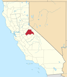 | |
| CDPs | ||
| Unincorporated communities | ||
| Ghost towns |
| |
This article is issued from
Wikipedia.
The text is licensed under Creative Commons - Attribution - Sharealike.
Additional terms may apply for the media files.