Matamoras, Indiana
| Matamoras | |
|---|---|
| Unincorporated community | |
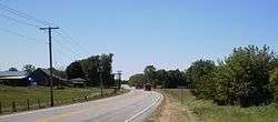 West entrance of Matamoras, Indiana | |
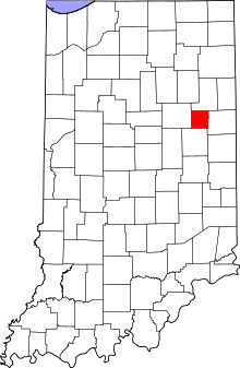 Blackford County's location in Indiana | |
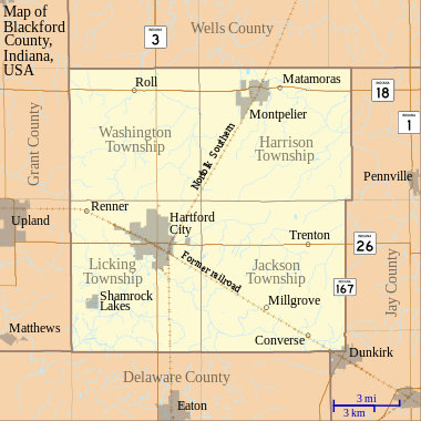 Matamoras Location in Blackford County | |
| Coordinates: 40°33′15″N 85°15′47″W / 40.55417°N 85.26306°WCoordinates: 40°33′15″N 85°15′47″W / 40.55417°N 85.26306°W | |
| Country | United States |
| State | Indiana |
| County | Blackford |
| Township | Harrison |
| Established | circa 1833 |
| Elevation | 869 ft (265 m) |
| ZIP code | 47359 |
| FIPS code | 18-47550[1] |
| GNIS feature ID | 438709[2] |
Matamoras is an unincorporated community in the northeast portion of Harrison Township, Blackford County, Indiana. Matamoras is Blackford County's oldest community, although it was not the first to be platted.[3]
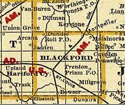
Blackford County, Indiana 1888
Geography
Matamoras is located on the Salamonie River, less than one mile east of Montpelier.
History
It was likely named after Matamoros, Mexico, a battleground in the Mexican–American War.[4]
Notes
- ↑ "American FactFinder". United States Census Bureau. Retrieved 2008-01-31.
- ↑ "Matamoras, Indiana". Geographic Names Information System. United States Geological Survey. Retrieved 2009-10-17.
- ↑ A History of Blackford County, p. 117.
- ↑ Baker, Ronald L. (October 1995). From Needmore to Prosperity: Hoosier Place Names in Folklore and History. Indiana University Press. p. 212. ISBN 978-0-253-32866-3.
This village probably was named for the Mexican city captured by American troops...
References
- A History of Blackford County, Indiana : with historical accounts of the county, 1838-1986 [and] histories of families who have lived in the county. Hartford City, Indiana: Blackford County Historical Society. 1986. p. 302. OCLC 15144953.
Municipalities and communities of Blackford County, Indiana, United States | ||
|---|---|---|
| Cities | ||
| Town | ||
| Townships | ||
| Unincorporated communities | ||
| Footnotes | ‡This populated place also has portions in an adjacent county or counties | |
This article is issued from
Wikipedia.
The text is licensed under Creative Commons - Attribution - Sharealike.
Additional terms may apply for the media files.