Massillon, Iowa
| Massillon, Iowa | |
|---|---|
| unincorporated community | |
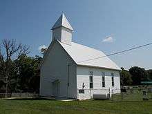 Church Upon a Hill | |
 Massillon, Iowa Location within the state of Iowa | |
| Coordinates: 41°54′53″N 90°55′22″W / 41.91472°N 90.92278°WCoordinates: 41°54′53″N 90°55′22″W / 41.91472°N 90.92278°W | |
| Country |
|
| State |
|
| County | Cedar County |
| Time zone | UTC-6 (Central (CST)) |
| • Summer (DST) | UTC-5 (CDT) |
| Area code(s) | 563 |
Massillon is an unincorporated community in Massillon Township, Cedar County, Iowa, United States. It is located south of the Wapsipinicon River on County Road Y24 west of Toronto and north of Lowden in the northeastern corner of the county, at 41.914844N, -90.922851W.[1]
History
The area where the town of Massillon was founded was originally known as Denson's Ferry, named after a Joseph Denson who ran a ferry on the Wapsipinicon River.[2] The town plat was founded in 1854 and was a station along the Davenport & Northern Railroad.[3] The town was named after the city of Massillon, Ohio located 540 miles (870 km) to the east on US 30.[4]
The first bridge was built over the Wapsipinicon River at Massillon in 1868 at the expense of $4,000.[5]
References
- ↑ "US Gazetteer files: 2010, 2000, and 1990". United States Census Bureau. 2011-02-12. Retrieved 2011-04-23.
- ↑ The History of Cedar County, Iowa: Containing a History of the County, Its Cities, Towns, etc. Western Historical Company. 1878. p. 546.
- ↑ The history of Cedar County, Iowa, Western Historical Co., 1878.
- ↑ Savage, Tom (2007). A Dictionary of Iowa Place-Names, p. 145. University Of Iowa Press. ISBN 1-58729-531-8.
- ↑ Aurner, Clarence Ray (1910). A Topical History of Cedar County, Iowa, Volume 1. S. J. Clarke. p. 76.
Municipalities and communities of Cedar County, Iowa, United States | ||
|---|---|---|
| Cities | ||
| Townships | ||
| CDP | ||
| Other unincorporated communities | ||
| Footnotes | ‡This populated place also has portions in an adjacent county or counties | |
This article is issued from
Wikipedia.
The text is licensed under Creative Commons - Attribution - Sharealike.
Additional terms may apply for the media files.