Massey, New Zealand
| Massey | |
|---|---|
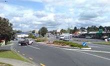 The roundabout Don Buck Road / Triangle Road in Massey North. | |
| Basic information | |
| Local authority | Auckland Council |
| Population | 20,085 (2013) |
| Surrounds | |
| North | Riverhead (town) |
| Northeast | West Harbour |
| East | Te Atatu |
| Southeast | Lincoln |
| South | Lincoln |
| Southwest | Ranui |
| West | Waitakere |
| Northwest | Kumeu (town) |
Massey is a north-western suburb in the city of Auckland, New Zealand. It was formerly a northern suburb of Waitakere City, which existed from 1989 to 2010 before the city was amalgamated into Auckland Council. The suburb was named after former Prime Minister of New Zealand William Massey. Massey is a relatively large suburb and can be divided into three reasonably distinctive areas, Massey West, Massey East (separated by the north-western motorway) and Massey North (situated to the north of Royal Road). Parts of Massey East are also known as 'Royal Heights', which is home to the Royal Heights shopping centre.
The population was 20,085 in the 2013 census, an increase of 1,326 from 2006. The population given is for the statistical areas of Westgate [1], Royal Road West [2], Royal Heights [3], Waimumu North [4] and Waimumu South [5]
Massey is home to one secondary school, Massey High School, where the principal is former Tall Blacks captain Glen Denham as well as several primary schools, including Colwill Primary School, Lincoln Heights School, Royal Road Primary School, Massey Primary School and Don Buck Primary School. Massey is not home to Massey University, which is based in Palmerston North with its Auckland campus at Albany. The suburb features a Leisure Centre and Library as well as the Westgate shopping centre on Hobsonville Road next to the north-western motorway and NorthWest Shopping Centre (which opened in October, 2015) to the north of Hobsonville Road.[6]
The local rugby club is a member of the North Harbour Rugby Union and won the championship 6 times (93, 2004, 2005, 2013, 2015 and 2016. Former All Black Jonah Lomu signed to play for Massey in 2005, but due to an injury was unable to play for them that season. He did however eventually make his debut for the club in 2006.
In Parliament Massey is represented by Member for Te Atatu Labour MP Phil Twyford and National list MP Alfred Ngaro. It is the centre of the local body ward of the same name that elects multiple councillors. The 'Massey Ward' contains the suburbs of Whenuapai, Hobsonville, Herald Island, West Harbour, Massey, Ranui, and Henderson North. It has a population of 49,413 (2006 census).[7]
Massey is home to rugby players George Pisi and Tusi Pisi (North Harbour, Samoa and New Zealand 7's) as well as the musicians Blindspott.
List of parks in the Massey suburb
- Claverdon Park
- Cyclarama Reserve
- Kemp Park
- Helena Park
- Keegan Park
- Lendich Reserve
- Lincoln Park
- Lowtherhurst Reserve
- Makora Park
- Massey Domain
- Moire Park
- Raelene Reserve
- Reynella Park
- Royal Reserve
- Sarajevo Reserve
- Spargo Reserve
- Sunline Park
- Taitapu Park
- Tatyana Park
- Triangle Park
- Zita Maria Park
References
- ↑ http://archive.stats.govt.nz/Census/2013-census/profile-and-summary-reports/quickstats-about-a-place.aspx?request_value=13329&parent_id=13171&tabname=&p=y&printall=true
- ↑ http://archive.stats.govt.nz/Census/2013-census/profile-and-summary-reports/quickstats-about-a-place.aspx?request_value=13330&parent_id=13171&tabname=&sc_device=pdf
- ↑ http://archive.stats.govt.nz/Census/2013-census/profile-and-summary-reports/quickstats-about-a-place.aspx?request_value=13333&parent_id=13171&tabname=&sc_device=pdf
- ↑ http://archive.stats.govt.nz/Census/2013-census/profile-and-summary-reports/quickstats-about-a-place.aspx?request_value=13337&parent_id=13171&tabname=&sc_device=pdf
- ↑ http://archive.stats.govt.nz/Census/2013-census/profile-and-summary-reports/quickstats-about-a-place.aspx?request_value=13338&parent_id=13171&tabname=&sc_device=pdf
- ↑ "Archived copy". Archived from the original on 30 September 2006. Retrieved 23 August 2006.
- ↑ "Massey Ward: A Profile of Waitakere City's Wards" (PDF). Waitakere City Council. p. M-3. Retrieved 7 December 2008.
External links
- Photographs of Massey held in Auckland Libraries' heritage collections.
- Massey's changing landscape Historypin collection.
Coordinates: 36°50′15″S 174°37′02″E / 36.837583°S 174.617346°E