Marwahin
| Marwahin مروحين | |
|---|---|
| Village | |
 Marwahin | |
| Coordinates: 33°07′N 35°17′E / 33.117°N 35.283°E | |
| Grid position | 176/279 PAL |
| Country |
|
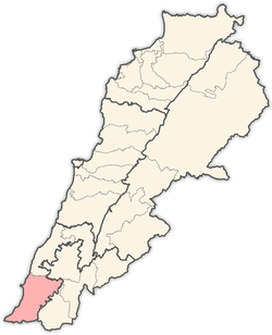
| Governorate | South Governorate |
| District | Tyre |
| Population (2011) | |
| • Total | 12,000 |
| Time zone | GMT +3 |
Marwahin (Arabic: مروحين; Marwāḩīn) is a town in Lebanon, on its border with Israel. A group of 23 residents, mostly children, were killed by Israel during the 2006 Lebanon War while attempting to evacuate under Israeli orders.[1][2]
Name
According to E. H. Palmer, the name comes either from: [..] "a place where the wind blows, effacing the traces of dwellings,' or from [..] "a fan".[3]
History
In 1875, Victor Guérin found here many ruins, with some Bedouin camping among the ruins.[4]
In 1881, the Palestine Exploration Fund's Survey of Western Palestine (SWP) found here: "Traces of ruins, one tomb with fourteen loculi, three cisterns, and one olive-press."[5]
Modern period
The people of the village are Sunni Muslims.[1]
During the 2006 Lebanon War, Marwahin was the site of ground exchanges between Israel and Hezbollah. According to Human Rights Watch, the villagers of Marwahin reported that there were some Hezbollah fighters and weapons in their village.[2]
Lebanese civilian refugees from the town were first ordered to flee the area by Israeli forces.[6][7] Only two persons survived the attack, by playing dead. According to Human Rights Watch, no weapons were found in the vehicles destroyed by the Israeli attacks and personnel who tried to recover the victims' bodies were attacked. According to Human Rights Watch, 23 civilians were killed by the Israeli strikes, including 14 children and 7 women.[8][9]
References
- 1 2 "Marwahin 15 July 2006 The anatomy of a massacre". Independent. 2006-11-30. Retrieved 2016-08-12.
- 1 2 "Why They Died". [Human Rights Watch]. September 2007.
- ↑ Palmer, 1881, p. 49
- ↑ Guérin, 1880, p. 133
- ↑ Conder and Kitchener, 1881, SWP I, p. 179
- ↑ "Robert Fisk: Why do they hate the West so much, we will ask". The Independent. 2009-07-01. Retrieved 2012-05-12.
- ↑ "Marwahin 15 July 2006 The anatomy of a massacre". Independent. 2006-11-30. Retrieved 2016-08-12.
- ↑ "Human Rights Watch and Israel: An Exchange". The New York Review of Books. 2006-11-02. Retrieved 2012-05-12.
- ↑ HRW, 2007, pp. 147-151
Bibliography
- Conder, C.R.; Kitchener, H.H. (1881). The Survey of Western Palestine: Memoirs of the Topography, Orography, Hydrography, and Archaeology. 1. London: Committee of the Palestine Exploration Fund.
- Guérin, V. (1880). Description Géographique Historique et Archéologique de la Palestine (in French). 3: Galilee, pt. 2. Paris: L'Imprimerie Nationale.
- Palmer, E.H. (1881). The Survey of Western Palestine: Arabic and English Name Lists Collected During the Survey by Lieutenants Conder and Kitchener, R. E. Transliterated and Explained by E.H. Palmer. Committee of the Palestine Exploration Fund.
Coordinates: 33°07′N 35°17′E / 33.117°N 35.283°E
External links
- Survey of Western Palestine, Map 3: IAA, Wikimedia commons
- Merouahine, Localiban
Capital: Tyre | ||
| Towns and villages |
|  |