Marrigudem
| Marrigudem మర్రిగూడెం Marriguda | |
|---|---|
| village | |
 Marrigudem Location in Telangana, India  Marrigudem Marrigudem (India) | |
| Coordinates: 17°05′25″N 79°14′48″E / 17.090167°N 79.246662°ECoordinates: 17°05′25″N 79°14′48″E / 17.090167°N 79.246662°E | |
| Country |
|
| State | Telangana |
| Region | Telangana |
| District | Nalgonda |
| Elevation | 421 m (1,381 ft) |
| Population (2011) | |
| • Total | 4,000 |
| Languages | |
| • Official | Telugu, Urdu |
| Time zone | UTC+5:30 (IST) |
| PIN | 508001 |
| Telephone code | 91 8682 |
| Vehicle registration | TS 05 |
'Marrigudem is a Village and Grampanchayat in Nalgonda mandal (Nalgonda district) in the Indian state of Telangana. The main source of income for the villagers is from Agriculture. The village is about 3 kilometers from Nalgonda (District Headquarters). As the village is very close to Nalgonda town, Villagers mostly depend on Dairy for livelihood. A Neighboring Village Girkabavigudem comes under Marrigudem Panchayithi election. Marrigudem Village has Government High School (Class 1 to 10).[1]
The first citizen of Marrigudem village is its Sarpanch (President) who is elected every 5 years. The village is divided into 13 wards and each ward has its ward member elected every 5 years.
Notes
- ↑ "Nalgonda Collectrate Office". nalgonda.nic.in.
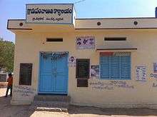
Marrigudem Village Panchayath Office
References
This article is issued from
Wikipedia.
The text is licensed under Creative Commons - Attribution - Sharealike.
Additional terms may apply for the media files.