Maarakeh
| Maarakeh معركة | |
|---|---|
| Village | |
 Maarakeh | |
| Coordinates: 33°16′N 35°18′E / 33.267°N 35.300°ECoordinates: 33°16′N 35°18′E / 33.267°N 35.300°E | |
| Grid position | 179/297 PAL |
| Country | Lebanon |
| Governorate | South Governorate |
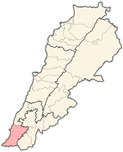
| District | Tyre |
| Time zone | +2 |
| • Summer (DST) | +3 |
Maarakeh (Arabic: معركة) is an ancient village in Tyre District, in Lebanon.
Geography
The Municipality of Maarakeh is located in the Kaza of Tyre (sour) one of Mohafazah of South Lebanon kazas (districts). Mohafazah of South Lebanon is one of the eight mohafazats (governorates) of Lebanon. It is 90 kilometers (55.9 mi) away from Beyrouth (Beirut) the capital of Lebanon. Its elevation is 270 meters (1) (886 ft - 295 yd) above sea level. Maarakeh surface stretches for 2000 hectares (20 km² - 7.7 mi²)(2).
Name
E. H. Palmer wrote that the name Mảrakeh meant "The battle field".[1]
History
In 1596, it was named as a village, al-Ma'raka, in the Ottoman nahiya (subdistrict) of Tibnin under the liwa' (district) of Safad, with a population of 119 households and 3 bachelors, all Muslim. The villagers paid a fixed tax rate of 25% on agricultural products, such as wheat, barley, olive trees, fruit trees, cotton, goats and beehives, in addition to occasional revenues; a total of 13,350 akçe.[2][3]
In 1875 Victor Guérin found that it had 700 Metawileh inhabitants.[4] He further noted: "Here are uprights and lintels of door with cut stones, apparently ancient; and in a small mosque, built of regular blocks probably taken from an old church, are several fragments of monolithic columns.'"[5]
In 1881, the Palestine Exploration Fund's Survey of Western Palestine (SWP) described it as: "A village, built of stone, containing about 400 Metawileh, on flat top of high ground, surrounded by gardens, olives, figs, palms, and arable land. There is a spring and five cisterns."[6]
Educational establishments
| Educational establishments | Maarakeh (2005-2006) | Lebanon (2005–2006) |
|---|---|---|
| Number of Schools | 5 | 2788 |
| Public School | 3 | 1763 |
| Private School | 2 | 1025 |
| Students schooled in the public schools | 1596 | 439905 |
| Students schooled in the private schools | 271 | 471409 |
Health Institutions
There are no health institution in the municipality.
References
- ↑ Palmer, 1881, p. 29
- ↑ Hütteroth and Abdulfattah, 1977, p. 180
- ↑ Note that Rhode, 1979, p. 6 writes that the register that Hütteroth and Abdulfattah studied was not from 1595/6, but from 1548/9
- ↑ Guérin, 1880, p. 262
- ↑ Guérin, 1880, p. 262; as cited in Conder and Kitchener, 1881, SWP I, p. 136
- ↑ Conder and Kitchener, 1881, SWP I, p. 93
Bibliography
- Conder, C.R.; Kitchener, H.H. (1881). The Survey of Western Palestine: Memoirs of the Topography, Orography, Hydrography, and Archaeology. 1. London: Committee of the Palestine Exploration Fund.
- Guérin, V. (1880). Description Géographique Historique et Archéologique de la Palestine (in French). 3: Galilee, pt. 2. Paris: L'Imprimerie Nationale.
- Hütteroth, Wolf-Dieter; Abdulfattah, Kamal (1977). Historical Geography of Palestine, Transjordan and Southern Syria in the Late 16th Century. Erlanger Geographische Arbeiten, Sonderband 5. Erlangen, Germany: Vorstand der Fränkischen Geographischen Gesellschaft. ISBN 3-920405-41-2.
- Palmer, E.H. (1881). The Survey of Western Palestine: Arabic and English Name Lists Collected During the Survey by Lieutenants Conder and Kitchener, R. E. Transliterated and Explained by E.H. Palmer. Committee of the Palestine Exploration Fund.
- Rhode, H. (1979). Administration and Population of the Sancak of Safed in the Sixteenth Century. Columbia University.
External links
- Survey of Western Palestine, Map 2: IAA, Wikimedia commons
- Localliban: Centre de resource sur le developpement local: www.localiban.org
Capital: Tyre | ||
| Towns and villages |
|  |