Manticao, Misamis Oriental
| Manticao | |
|---|---|
| Municipality | |
| Municipality of Manticao | |
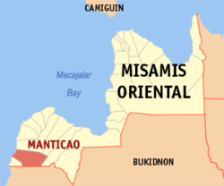 Map of Misamis Oriental with Manticao highlighted | |
.svg.png) Manticao Location within the Philippines | |
| Coordinates: 8°24′N 124°17′E / 8.4°N 124.28°ECoordinates: 8°24′N 124°17′E / 8.4°N 124.28°E | |
| Country |
|
| Region | Northern Mindanao (Region X) |
| Province | Misamis Oriental |
| District | 2nd District |
| Founded | February 7, 1949 |
| Barangays | 13 (see Barangays) |
| Government [1] | |
| • Type | Sangguniang Bayan |
| • Mayor | Roberto M. Lagrosas |
| • Electorate | 18,629 voters (2016) |
| Area [2] | |
| • Total | 123.01 km2 (47.49 sq mi) |
| Population (2015 census)[3] | |
| • Total | 28,422 |
| • Density | 230/km2 (600/sq mi) |
| Time zone | UTC+8 (PST) |
| ZIP code | 9024 |
| PSGC | 104318000 |
| IDD : area code | +63 (0)88 |
| Climate type | Tropical climate |
| Income class | 4th municipal income class |
| Revenue (₱) | 81,985,361.11 (2016) |
| Native languages |
Cebuano Binukid Subanon language Tagalog |
| Website |
www |
Manticao, officially the Municipality of Manticao, is a 4th class municipality in the province of Misamis Oriental, Philippines. According to the 2015 census, it has a population of 28,422 people.[3]
Manticao River was known as Naawan River until 1957, when it was renamed.[4]
Geography
Manticao's geographical features consist of mountainous to flat plains to shorelines.
Barangays
Manticao is politically subdivided into 13 barangays.
- Argayoso
- Balintad
- Cabalantian
- Camanga
- Digkilaan
- Mahayahay
- Pagawan
- Paniangan
- Patag
- Poblacion
- Punta Silum
- Tuod
- Upper Malubog
Demographics
| Population census of Manticao | |||||||||||||||||||||||||||||||||||||
|---|---|---|---|---|---|---|---|---|---|---|---|---|---|---|---|---|---|---|---|---|---|---|---|---|---|---|---|---|---|---|---|---|---|---|---|---|---|
|
| ||||||||||||||||||||||||||||||||||||
| Source: Philippine Statistics Authority[3][5][6][7] | |||||||||||||||||||||||||||||||||||||
In the 2015 census, the population of Manticao was 28,422 people,[3] with a density of 230 inhabitants per square kilometre or 600 inhabitants per square mile.
References
- ↑ "Municipality". Quezon City, Philippines: Department of the Interior and Local Government. Retrieved 31 May 2013.
- ↑ "Province: Misamis Oriental". PSGC Interactive. Quezon City, Philippines: Philippine Statistics Authority. Retrieved 12 November 2016.
- 1 2 3 4 Census of Population (2015). "Region X (Northern Mindanao)". Total Population by Province, City, Municipality and Barangay. PSA. Retrieved 20 June 2016.
- ↑ "An Act Changing the Name of Naawan River in the Municipality of Manticao, Province of Misamis Oriental, to Manticao River". LawPH.com. Retrieved 2011-04-12.
- ↑ Census of Population and Housing (2010). "Region X (Northern Mindanao)". Total Population by Province, City, Municipality and Barangay. NSO. Retrieved 29 June 2016.
- ↑ Censuses of Population (1903–2007). "Region X (Northern Mindanao)". Table 1. Population Enumerated in Various Censuses by Province/Highly Urbanized City: 1903 to 2007. NSO.
- ↑ "Province of Misamis Oriental". Municipality Population Data. Local Water Utilities Administration Research Division. Retrieved 17 December 2016.
External links
- Philippine Standard Geographic Code
- Philippine Census Information
- Local Governance Performance Management System
Places adjacent to Manticao, Misamis Oriental | ||||||||||
|---|---|---|---|---|---|---|---|---|---|---|
| ||||||||||
Cagayan de Oro (capital) | |
| Municipalities | |
| Component cities | |
| Highly urbanized city |
|
This article is issued from
Wikipedia.
The text is licensed under Creative Commons - Attribution - Sharealike.
Additional terms may apply for the media files.