Mansewood, Ontario
| Mansewood | |
|---|---|
| Unincorporated community | |
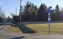 Looking east on Number 5 Sideroad in Mansewood | |
 Mansewood Location of Mansewood in Canada  Mansewood Mansewood (Ontario) | |
| Coordinates: 43°33′05″N 79°54′29″W / 43.55139°N 79.90806°WCoordinates: 43°33′05″N 79°54′29″W / 43.55139°N 79.90806°W | |
| Country | Canada |
| Province | Ontario |
| Regional municipality | Halton |
| Town | Halton Hills |
| Time zone | UTC-5 (Eastern (EST)) |
| • Summer (DST) | UTC-4 (EDT) |
| GNBC Code | FDKOD[1] |
Mansewood is an unincorporated community in Halton Hills, Ontario, Canada.[1]
Middle Sixteen Mile Creek flows through the settlement.
The early settlement was part of The Scotch Block, a large agricultural area in Esquesing Township occupied primarily by Scottish immigrants.[2]
History
A cemetery is located west of the settlement and contains a grave dating to 1815.[3]
Mansewood had a post office from 1877 to 1914.[4]
In 1889, Owen Robertson, a farmer from Mansewood, was noted for the exceptional growth of his Prize Cluster Oats, an experimental variety. Robertson produced 59 kilograms (130 lb) of oats from just 1.4 kilograms (3 lb) of seed.[5]
References
- 1 2 "Mansewood". Natural Resources Canada. October 6, 2016.
- ↑ Arnott, Kim (September 23, 2005). "Scottish Roots Firmly Planted in North Halton". The Canadian Champion.
- ↑ "United Presbyterian / Mansewood United Presbyterian Cemetery". CanadaGenWeb Cemetery Project. Retrieved March 22, 2017.
- ↑ "Mansewood". Library and Archives Canada. May 27, 2014.
- ↑ Appendix to the Report of the Minister of Agriculture - Experimental Farms. Minister of Agriculture. 1889. pp. 11, 12.
This article is issued from
Wikipedia.
The text is licensed under Creative Commons - Attribution - Sharealike.
Additional terms may apply for the media files.