Mandalapalli
| Mandalapally | |
|---|---|
| village | |
 Mandalapally Location in Andhra Pradesh, India | |
| Coordinates: 17°16′00″N 81°01′00″E / 17.2667°N 81.0167°ECoordinates: 17°16′00″N 81°01′00″E / 17.2667°N 81.0167°E | |
| Country |
|
| State | Telangana |
| District | Bhadradri Kothagudem |
| Elevation | 267 m (876 ft) |
| Languages | |
| • Official | Telugu |
| Time zone | UTC+5:30 (IST) |
| Vehicle registration | TS |
| Nearest city | Khammam |
| Lok Sabha constituency | khammam |
| Vidhan Sabha constituency | Aswaraopeta |
| Climate | hot (Köppen) |
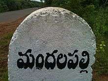
Mandalapalli Village boundary stone
Mandalapalli (Telugu: మ౦దలపలి) is a Village in Dammapeta mandal in Bhadradri Kothagudem district, Telangana.
Geography
Mandalapalli has an average elevation of 206 metres (679 ft). Located on the highway connecting Khammam and Rajahmundry between Sathupalli and Aswaraopeta.
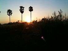
The village has green fields, plantations, forest, hills, hillocks, ponds, lakes, and cattle.
Economy
Most the people are in agriculture. Paddy, maize, sugarcane, and groundnut are the main crops. Mango, cashew nut, palm oil and coconut are major plantation crops. All these crops are irrigated either from ground water or lakes.
There are many nurseries providing mainly mango plants.
As Mandalapalli is located on the highway, some people run small business like hotels and dhabas.
Places of worship
- Rama Temple
- Hanuman Temple
- Sai Baba Temple
Schools
- APTWREIS DAMMAPETA, DAMMAPETA
- APSWREIS MANDALAPALLI, MANDALAPALLI
- ZPSS MANDALAPALLI, MANDALAPALLI
This article is issued from
Wikipedia.
The text is licensed under Creative Commons - Attribution - Sharealike.
Additional terms may apply for the media files.