Manda Airport
| Manda Airport | |||||||||||||||
|---|---|---|---|---|---|---|---|---|---|---|---|---|---|---|---|
| Summary | |||||||||||||||
| Airport type | Public, Civilian | ||||||||||||||
| Owner | Government of Kenya | ||||||||||||||
| Operator | Kenya Airports Authority | ||||||||||||||
| Serves | Lamu | ||||||||||||||
| Location |
Manda Island, Lamu Archipelago, | ||||||||||||||
| Elevation AMSL | 20 ft / 6 m | ||||||||||||||
| Coordinates | 02°14′46″S 40°54′36″E / 2.24611°S 40.91000°E | ||||||||||||||
| Map | |||||||||||||||
 HKLU Location of Manda Airport in Kenya Placement on map is approximate | |||||||||||||||
| Runways | |||||||||||||||
| |||||||||||||||
Manda Airport (IATA: LAU, ICAO: HKLU), also called Lamu Airport, is an airport in Kenya.
Location
Manda Airport is located in on Manda Island in the Lamu Archipelago of Lamu County on the western shore of the Indian Ocean, on the Kenya coast.
Its location is approximately 450 kilometres (280 mi), by air, southeast of Nairobi International Airport, the country's largest civilian airport.[1] The geographic coordinates of this airport are:2° 14' 46.00"S, 40° 54' 36.00"E (Latitude:-2.246110; Longitude:40.910000).
Overview
Manda Airport is a small civilian airport on Manda Island, serving the Lamu Archipelago in Kenya. Situated at 6 metres (20 ft) above sea level,[2] the airport has two runways. The first runway (16/34) is paved with asphalt and measures 4,085 feet (1,245 m) in length and 60 feet (18 m) in width. The second runway (08/26) is unpaved and is 3,054 feet (931 m) long and 46 feet (14 m) wide.[3]
Airlines and destinations
| Airlines | Destinations |
|---|---|
| Airkenya Express | Malindi, Nairobi–Wilson |
| Safarilink | Kiwayu, Nairobi–Wilson |
| Fly540 | Malindi, Nairobi–Jomo Kenyatta |
| Fly-SAX | Malindi, Nairobi–Wilson |
| Mombasa Air Safari | Malindi, Mombasa |
| Skyward Express | Nairobi–Wilson, Mombasa |
Accidents and incidents
On 14 October 2003 at about 9.00 am, local time, a Cessna 208 Caravan I owned and operated by Airkenya Express, with one pilot and no passengers, took off from Wilson Airport in Nairobi, headed for Manda Airport in Lamu, approximately 450 kilometres (280 mi), by air, to the southeast. Soon after becoming airborne, the aircraft lost height, crash-landed in Nairobi National Park and overturned. The pilot sustained minor injuries. The aircraft was written off.[4]
See also
References
- ↑ "Distance between Jomo Kenyatta Airport Nairobi (Nairobi Area) and Lamu Island (Coast) (Kenya)". distancecalculator.globefeed.com. Retrieved 2018-08-21.
- ↑ "Site Weather Station HKBA in Busia Airport, WE, Kenya". CWOP Weather. Retrieved 2018-08-21.
- ↑ Detailed Measurements of Manda Airport Runways
- ↑ Ranter, Harro. "ASN Aircraft accident Cessna 208 Caravan I 5Y-BOY Nairobi-Wilson Airport (WIL)". aviation-safety.net. Retrieved 2018-08-21.
External links
- Location of Manda Airport At Google Maps
- Website of Kenya Airports Authority
- List of Airports In Kenya
- Airport information for HKLU at Great Circle Mapper.
- Kenya Airports Authority – Manda Airstrip
- Accident history for LAU at Aviation Safety Network
| Lamu Island | 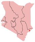 | |
|---|---|---|
| Manda Island |
| |
| Pate Island |
| |
| Kiwayu Island | ||
Coordinates: 2°14′46″S 40°54′36″E / 2.246110°S 40.910000°E