Mamolj
| Mamolj | |
|---|---|
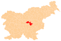
 Mamolj Location in Slovenia | |
| Coordinates: 46°3′55.06″N 14°55′20.32″E / 46.0652944°N 14.9223111°ECoordinates: 46°3′55.06″N 14°55′20.32″E / 46.0652944°N 14.9223111°E | |
| Country |
|
| Traditional region | Lower Carniola |
| Statistical region | Central Slovenia |
| Municipality | Litija |
| Area | |
| • Total | 5.68 km2 (2.19 sq mi) |
| Elevation | 608.4 m (1,996.1 ft) |
| Population (2002) | |
| • Total | 112 |
| [1] | |
Mamolj (pronounced [ˈmaːmɔl]; German: Mamol[2]) is a settlement in the hills east of Litija in central Slovenia. Traditionally the area was part of Lower Carniola and is now included with the rest of the Municipality of Litija in the Central Sava Statistical Region.[3] It includes the hamlets of Spodnji Mamolj (German: Untermamol[2]), Zgornji Mamolj (German: Obermamol[2]), Čebelnik, Češek, Podmilj, Resnarica, and Trinkavs.[4]
The local church is dedicated to John the Baptist and belongs to the Parish of Polšnik. It was built in the 18th century.[5]
References
- ↑ Statistical Office of the Republic of Slovenia
- 1 2 3 Leksikon občin kraljestev in dežel zastopanih v državnem zboru, vol. 6: Kranjsko. 1906. Vienna: C. Kr. Dvorna in Državna Tiskarna, pp. 94–95.
- ↑ Litija municipal site
- ↑ Savnik, Roman, ed. 1971. Krajevni leksikon Slovenije, vol. 2. Ljubljana: Državna založba Slovenije, p. 273.
- ↑ Slovenian Ministry of Culture register of national heritage reference number ešd 2156
External links
This article is issued from
Wikipedia.
The text is licensed under Creative Commons - Attribution - Sharealike.
Additional terms may apply for the media files.