Mamers, North Carolina
| Mamers, North Carolina | |
|---|---|
| Census-designated place | |
 Mamers  Mamers | |
| Coordinates: 35°25′1″N 78°56′8″W / 35.41694°N 78.93556°WCoordinates: 35°25′1″N 78°56′8″W / 35.41694°N 78.93556°W | |
| Country | United States |
| State | North Carolina |
| County | Harnett |
| Area | |
| • Total | 6.05 sq mi (15.67 km2) |
| • Land | 6.04 sq mi (15.65 km2) |
| • Water | 0.008 sq mi (0.02 km2) |
| Elevation | 335 ft (102 m) |
| Population (2010) | |
| • Total | 826 |
| • Density | 137/sq mi (52.8/km2) |
| Time zone | UTC-5 (Eastern (EST)) |
| • Summer (DST) | UTC-4 (EDT) |
| ZIP code | 27552 |
| Area code(s) | 910 |
| FIPS code | 37-40860[1] |
| GNIS feature ID | 1021335[2] |
Mamers is an unincorporated community and census-designated place (CDP) in Harnett County, North Carolina, United States. The population was 826 at the 2010 census.[1] It is a part of the Dunn Micropolitan Area, which is also a part of the greater Raleigh–Durham–Cary Combined Statistical Area (CSA) as defined by the United States Census Bureau.
Geography
The community is in west-central Harnett County in Upper Little River Township. U.S. Route 421 is the main road through the northern side of the community, and Old US Highway 421 runs through the center. Lillington, the county seat, is 7 miles (11 km) to the east, and Sanford is 15 miles (24 km) to the west. Immediate neighbors of Mamers are Luart to the east and Ryes to the west.[3]:310 According to the United States Census Bureau, the Mamers CDP has a total area of 6.1 square miles (15.7 km2), of which 0.01 square miles (0.02 km2), or 0.15%, are water.[1]
Prominent nearby landmarks include the community United States Post Office (ZIP Code 27552). Mamers is in the Boone Trail Elementary School district as well as in the Western Harnett middle and high school districts.
References
- 1 2 3 "Geographic Identifiers: 2010 Census Summary File 1 (G001): Mamers CDP, North Carolina". American Factfinder. U.S. Census Bureau. Retrieved December 13, 2017.
- ↑ U.S. Geological Survey Geographic Names Information System: Mamers, North Carolina
- ↑ Powell, William S. (1968). The North Carolina Gazetteer: A Dictionary of Tar Heel Places. Chapel Hill: University of North Carolina Press. ISBN 0-8078-1247-1.
Municipalities and communities of Harnett County, North Carolina, United States | ||
|---|---|---|
| City | 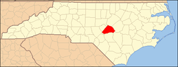 | |
| Towns | ||
| Townships | ||
| CDPs | ||
| Unincorporated communities | ||
| Footnotes | ‡This populated place also has portions in an adjacent county or counties | |