Bunnlevel, North Carolina
| Bunnlevel, North Carolina | |
|---|---|
| Census-designated place | |
 Bunnlevel  Bunnlevel | |
| Coordinates: 35°18′32″N 78°46′51″W / 35.30889°N 78.78083°WCoordinates: 35°18′32″N 78°46′51″W / 35.30889°N 78.78083°W | |
| Country | United States |
| State | North Carolina |
| County | Harnett |
| Area | |
| • Total | 7.59 sq mi (19.66 km2) |
| • Land | 7.56 sq mi (19.58 km2) |
| • Water | 0.03 sq mi (0.09 km2) |
| Elevation | 146 ft (45 m) |
| Population (2010) | |
| • Total | 552 |
| • Density | 73/sq mi (28.2/km2) |
| Time zone | UTC-5 (Eastern (EST)) |
| • Summer (DST) | UTC-4 (EDT) |
| ZIP code | 28323 |
| Area code(s) | 910 |
| FIPS code | 37-08880[1] |
| GNIS feature ID | 1019407[2] |
Bunnlevel is an unincorporated community and census-designated place (CDP) along U.S. Highway 401 in Stewarts Creek Township, Harnett County, North Carolina, United States. The population was 552 at the 2010 census.[1] It is a part of the Dunn Micropolitan Area, which is also a part of the greater Raleigh–Durham–Cary Combined Statistical Area (CSA) as defined by the United States Census Bureau.
History
Bunnlevel was originally named "Bunn's Level" after a local resident and was settled around 1904. The community was incorporated in 1921 as "Bunlevel" but has since been inactive as a municipality. Another incorporation movement here failed in 1961.[3] Prominent families included McDougald, McNeill, McLean, Walker, Spears, Gunn, Chance and Hicks.
Thorbiskope was listed on the National Register of Historic Places in 1986.[4]
Geography
The community is in southern Harnett County along U.S. Route 401, 7 miles (11 km) south of Lillington, the county seat, and 20 miles (32 km) north of Fayetteville. According to the United States Census Bureau, the Bunnlevel CDP has a total area of 7.59 square miles (19.66 km2), of which 7.56 square miles (19.58 km2) are land and 0.03 square miles (0.09 km2), or 0.44%, are water.[1]
References
- 1 2 3 "Geographic Identifiers: 2010 Census Summary File 1 (G001): Bunnlevel CDP, North Carolina". American Factfinder. U.S. Census Bureau. Retrieved December 13, 2017.
- ↑ U.S. Geological Survey Geographic Names Information System: Bunnlevel, North Carolina
- ↑ Powell, William S. (1968), The North Carolina Gazetteer: A Dictionary of Tar Heel Places, Chapel Hill: University of North Carolina Press, p. 75, ISBN 0-8078-1247-1
- ↑ National Park Service (2010-07-09). "National Register Information System". National Register of Historic Places. National Park Service.
Municipalities and communities of Harnett County, North Carolina, United States | ||
|---|---|---|
| City | 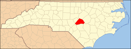 | |
| Towns | ||
| Townships | ||
| CDPs | ||
| Unincorporated communities | ||
| Footnotes | ‡This populated place also has portions in an adjacent county or counties | |