Maluso, Basilan
| Maluso | |
|---|---|
| Municipality | |
| Municipality of Maluso | |
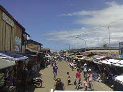 Port Holland, Maluso | |
 Map of Basilan with Maluso highlighted | |
.svg.png) Maluso Location within the Philippines | |
| Coordinates: 6°33′N 121°53′E / 6.55°N 121.88°ECoordinates: 6°33′N 121°53′E / 6.55°N 121.88°E | |
| Country |
|
| Region | Autonomous Region in Muslim Mindanao (ARMM) |
| Province | Basilan |
| District | Lone District |
| Barangays | 20 (see Barangays) |
| Government [1] | |
| • Type | Sangguniang Bayan |
| • Mayor | Hanie A. Bud |
| • Electorate | 23,436 voters (2016) |
| Area [2] | |
| • Total | 168.46 km2 (65.04 sq mi) |
| Population (2015 census)[3] | |
| • Total | 40,646 |
| • Density | 240/km2 (620/sq mi) |
| Time zone | UTC+8 (PST) |
| ZIP code | 7303 |
| PSGC | 150704000 |
| IDD : area code | +63 (0)62 |
| Climate type | Tropical climate |
| Income class | 4th municipal income class |
| Revenue (₱) | 87,333,694.47 (2016) |
| Native languages |
Yakan Chavacano Tagalog |
Maluso, officially the Municipality of Maluso, (Tausūg: Lupah Maluso; Chavacano: Municipalidad de Maluso; Tagalog: Bayan ng Maluso), is a 4th class municipality in the province of Basilan, Philippines. According to the 2015 census, it has a population of 40,646 people.[3]
On February 27, 2010, about 70 militants of the extremist Abu Sayyaf group attacked Tubigan village in Maluso, setting fire to homes and killing at least 11 people.[4]
Barangays
Maluso is politically subdivided into 20 barangays.[5]
| PSGC | Barangay | Population | ±% p.a. | |||
|---|---|---|---|---|---|---|
| 2015[3] | 2010[6] | |||||
| 150704001 | Abong-Abong | 2.4% | 965 | 846 | 2.54% | |
| 150704002 | Batungal | 3.0% | 1,207 | 924 | 5.22% | |
| 150704003 | Calang Canas | 7.0% | 2,862 | 1,101 | 19.95% | |
| 150704016 | Fuente Maluso | 2.9% | 1,185 | 1,261 | −1.18% | |
| 150704004 | Guanan North (Zone I) | 2.7% | 1,079 | 1,089 | −0.18% | |
| 150704005 | Guanan South (Zone II) | 3.3% | 1,336 | 1,202 | 2.03% | |
| 150704006 | Limbubong | 2.4% | 976 | 1,220 | −4.16% | |
| 150704007 | Mahayahay Lower (Zone I) | 1.5% | 595 | 671 | −2.26% | |
| 150704019 | Mahayahay Upper (Zone II) | 3.1% | 1,252 | 1,112 | 2.28% | |
| 150704008 | Muslim Area | 1.3% | 509 | 440 | 2.81% | |
| 150704009 | Port Holland Zone I Poblacion (Upper) | 9.3% | 3,784 | 3,171 | 3.42% | |
| 150704010 | Port Holland Zone II Poblacion (Shipyard Main) | 6.5% | 2,649 | 2,436 | 1.61% | |
| 150704011 | Port Holland Zone III Poblacion (Samal Village) | 11.1% | 4,532 | 3,417 | 5.52% | |
| 150704012 | Port Holland Zone IV (Lower) | 14.4% | 5,834 | 3,355 | 11.11% | |
| 150704020 | Port Holland Zone V (Shipyard Tabuk) | 5.1% | 2,054 | 1,444 | 6.94% | |
| 150704015 | Taberlongan | 4.6% | 1,855 | 2,046 | −1.85% | |
| 150704017 | Tamuk | 2.4% | 976 | 1,008 | −0.61% | |
| 150704013 | Townsite (Poblacion) | 12.3% | 4,993 | 4,820 | 0.67% | |
| 150704018 | Tubigan | 3.5% | 1,424 | 1,649 | −2.75% | |
| 150704021 | Upper Garlayan | 1.4% | 579 | 591 | −0.39% | |
| Total | 40,646 | 33,803 | 3.57% | |||
Demographics
| Population census of Maluso | ||
|---|---|---|
| Year | Pop. | ±% p.a. |
| 1960 | 16,869 | — |
| 1970 | 15,519 | −0.83% |
| 1975 | 12,665 | −3.99% |
| 1980 | 17,287 | +6.42% |
| 1990 | 18,666 | +0.77% |
| 1995 | 26,844 | +7.05% |
| 2000 | 31,054 | +3.17% |
| 2007 | 48,178 | +6.24% |
| 2010 | 33,803 | −12.10% |
| 2015 | 40,646 | +3.57% |
| Source: PSA[3][6][7] | ||
In the 2015 census, Maluso had a population of 40,646.[3] The population density was 240 inhabitants per square kilometre (620/sq mi).
References
- ↑ "Municipality". Quezon City, Philippines: Department of the Interior and Local Government. Retrieved 31 May 2013.
- ↑ "Province: Basilan". PSGC Interactive. Quezon City, Philippines: Philippine Statistics Authority. Retrieved 12 November 2016.
- 1 2 3 4 5 Census of Population (2015). "ARMM – Autonomous Region in Muslim Mindanao". Total Population by Province, City, Municipality and Barangay. PSA. Retrieved 20 June 2016.
- ↑ "Abu Sayyaf militants raid Philippine village". BBC News. 27 February 2010. Archived from the original on 2 March 2010. Retrieved 10 November 2016.
- ↑ "Municipal: Maluso, Basilan". PSGC Interactive. Quezon City, Philippines: Philippine Statistics Authority. Retrieved 8 January 2016.
- 1 2 Census of Population and Housing (2010). "ARMM – Autonomous Region in Muslim Mindanao". Total Population by Province, City, Municipality and Barangay. NSO. Retrieved 29 June 2016.
- ↑ Censuses of Population (1903–2007). "ARMM – Autonomous Region in Muslim Mindanao". Table 1. Population Enumerated in Various Censuses by Province/Highly Urbanized City: 1903 to 2007. NSO.
Lamitan (capital) | ||
| Municipalities |  | |
| Component cities |
| |
This article is issued from
Wikipedia.
The text is licensed under Creative Commons - Attribution - Sharealike.
Additional terms may apply for the media files.