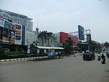
Mal Kelapa Gading
 | |
| Location | Kelapa Gading, Jakarta, Indonesia |
|---|---|
| Opening date | 1990 |
| Owner | PT Summarecon Agung Tbk |
| No. of stores and services | 600+ |
| No. of anchor tenants | 4 |
| Total retail floor area | 130,000 m² |
| Website | www.malkelapagading.com |
Mal Kelapa Gading (English: Kelapa Gading Mall) opened on 1990, is a modern shopping and entertainment center located in Kelapa Gading, Jakarta, Indonesia. It is one of the largest shopping mall in Indonesia with over 130,000 m² of floor space and 600+ stores.
History

Mall Kelapa Gading comprises several parts, namely Mall Kelapa Gading 1,2,3,5, La Piazza and Gading Food City.
Mal Kelapa Gading had its humble beginnings in 1990, then known as Kelapa Gading Plaza.The mall went through a phase 2 extension in 1995. On April 10, 2003 Mal Kelapa Gading opened Phase 3. This phase brought the total mall size to 130,000 m² and a total of 600 stores in the mall. [1] Mal Kelapa Gading is also organized by sections. There is a section for exclusive clothing (The Catwalk), teenage shopping area (Fashion Hub), and wedding shopping needs (Bridal World). Kids Safari edutainment (education and entertainment) facility that provides playground for kids and one stop shopping service. In addition, Mal Kelapa Gading has 2 sections for food, with cafes being in the Gourmet Walk and a 6000 m² food-court in Food Temptation.
The mall complex also includes La Piazza, a structure dedicated to restaurants and cafes. The mall also provides entertainment facilities including a Gading 21 cinema, Timezone games gallery and a 24-lane bowling Viva bowling alley.
Ownership
The shopping centre is owned and is operated by PT Summarecon Agung Tbk., a property company listed on the Indonesia Stock Exchange
Structure
Mal Kelapa Gading has a total gross area of 130,000 m² on three floors. There are over 600 tenants, more than 30 exclusive fashion boutiques, 6,000 m² of food court, three cinemas and several other entertainment facilities.
See also
External links
References
- ↑ http://www.malkelapagading.com/ Mall Kelapa Garding
| Jakarta |
| ||||||||||
|---|---|---|---|---|---|---|---|---|---|---|---|
| Surabaya |
| ||||||||||
| Medan |
| ||||||||||
| Elsewhere | |||||||||||
Coordinates: 6°09′26″S 106°54′30″E / 6.157284°S 106.908447°E