East Jakarta
| East Jakarta | ||
|---|---|---|
| Administrative city | ||
|
Administrative city of East Jakarta Kota Administrasi Jakarta Timur | ||
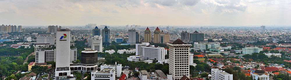
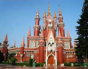   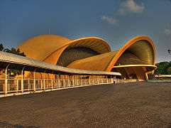 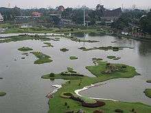  From top, left to right: Istana Boneka in Taman Mini Indonesia Indah, Hotel Balairung, Lubang Buaya Well, Keong Emas IMAX Theatre, Miniature of Indonesia in Taman Mini Indonesia Indah, Museum of PKI (Communist) Treason | ||
| ||
 | ||
| Country |
| |
| Province |
| |
| Government | ||
| • Mayor | HR. Krisdianto | |
| Area | ||
| • Total | 188.03 km2 (72.60 sq mi) | |
| Population (2010 Census) | ||
| • Total | 2,687,027 | |
| • Density | 14,000/km2 (37,000/sq mi) | |
| Time zone | UTC+7 (WIB) | |
| Website | timur.jakarta.go.id | |
East Jakarta (Indonesian: Jakarta Timur) is one of the five administrative cities (kota) which form Special Capital Region of Jakarta, Indonesia. It had a population of 2,687,027 at the 2010, making it the most populous of the five cities within Jakarta.
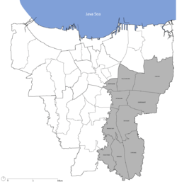
East Jakarta is bounded by North Jakarta to the north, Bekasi to the east, Depok to the south, and South Jakarta and Central Jakarta to the west.
The governor's office is located in the Administrative Village (Kelurahan) of Jatinegara, in the Jatinegara Subdistrict.
Economy
Aviastar Mandiri has its head office in East Jakarta.[1]
In the past, in East Jakarta, there are 23 Sugar mills such as Setu, Jatiwarna, Ceger, Kalijereng, Pedongkelan (Cimanggis), Palsigunung, Klender, Pondokjati and Cibubur is open in 1914 and is closed due to the 1997 financial crisis.
Sugar mills is open first is Klender ((in Dutch): Suikerfabriek Klender) in 1905.
Subdistricts
East Jakarta is divided into 10 subdistricts:
Transportation
- Halim Perdanakusuma International Airport serves a limited customer base; typically within an hour flight of the airport.[2]
- Kampung Rambutan Bus Terminal mainly provides service to inter-provincial, inter-city buses.
- Pulogebang inter-city and inter-province bus terminal, opened on June 23, 2012.[3]
References
- ↑ "Contact Us." (Archive) Aviastar. Retrieved on May 10, 2012. "Puri Sentra Niaga Blok B No. 29 Jalan Raya Kalimalang Jakarta Timur 13620 Indonesia"
- ↑ "Soekarno-Hatta must be expanded to meet passenger demand" ( Archived August 17, 2015, at WebCite). The Jakarta Post. Wednesday September 1, 2010. Retrieved on September 16, 2010. "Starting operation in 1985, Soekarno-Hatta airport replaced Kemayoran airport in Central Jakarta and Halim Perdanakusuma airport in East Jakarta"
- ↑ "Jakarta to Soft Open 'Most Modern' Bus Terminal on Saturday". June 22, 2012.
External links
| Wikimedia Commons has media related to East Jakarta. |
- (in Indonesian) Official site

Coordinates: 6°14′43″S 106°54′02″E / 6.24528°S 106.90056°E