Makarora
| Makarora | |
|---|---|
| Community | |
 Makarora | |
| Coordinates: 44°14′S 169°14′E / 44.233°S 169.233°ECoordinates: 44°14′S 169°14′E / 44.233°S 169.233°E | |
| Country | New Zealand |
| Region | Otago |
| Territorial authority | Queenstown-Lakes District |
| Time zone | UTC+12 (NZST) |
| • Summer (DST) | UTC+13 (NZDT) |
| Local iwi | Ngāi Tahu |
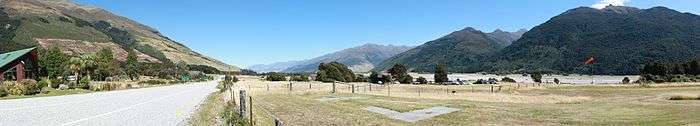
Makarora is a small community within the Queenstown-Lakes District of the Otago region of the South Island of New Zealand.
It is situated on State Highway 6 on the eastern side of the Haast Pass and adjacent to the Makarora River.
Local tourism operators offer scenic plane flights and jetboating tours on the Makarora River, which is the border of the Mount Aspiring National Park.
This article is issued from
Wikipedia.
The text is licensed under Creative Commons - Attribution - Sharealike.
Additional terms may apply for the media files.