Majšperk
| Majšperk | |
|---|---|
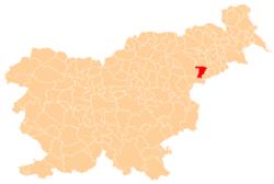
 Majšperk Location of Majšperk in Slovenia | |
| Coordinates: 46°21′N 15°44′E / 46.350°N 15.733°ECoordinates: 46°21′N 15°44′E / 46.350°N 15.733°E | |
| Country |
|
| Traditional region | Styria |
| Statistical region | Drava |
| Municipality | Majšperk |
| Elevation | 249.1 m (817.3 ft) |
| Population (2002)[1] | |
| • Total | 662 |
| Time zone | UTC+01 (CET) |
| • Summer (DST) | UTC+02 (CEST) |
Majšperk (pronounced [ˈmaːi̯ʃpɛɾk]) is a settlement in the Municipality of Majšperk in northeastern Slovenia. It is the seat of the municipality. Traditionally the area was part of the Styria region. The municipality is now included in the Drava Statistical Region.[2]
Name
Majšperk was first mentioned as Mannesperch in written documents dating to 1261 (and as Mansperch in 1263 and 1371, and Monsperg in 1426).[3] The name is derived from 13th-century Majšperk Castle (German: Monsberg).[4] The castle fell into disrepair in the late 19th century and today only ruins remain.[5] The castle name is a compound of the genitive form of the Old High German name Manne plus berg 'mountain', originally meaning 'Manno's mountain'.[3]
Church
The parish church in the settlement is dedicated to Saint Nicholas and belongs to the Roman Catholic Archdiocese of Maribor. It dates to the 13th century, but the current church was built in 1639.[6]
References
- ↑ Statistical Office of the Republic of Slovenia, census of 2002
- ↑ Majšperk municipal site
- 1 2 Snoj, Marko. 2009. Etimološki slovar slovenskih zemljepisnih imen. Ljubljana: Modrijan and Založba ZRC, p. 250.
- ↑ Gradovi v Sloveniji: Majšperk (in Slovene)
- ↑ Slovenian Ministry of Culture register of national heritage reference number ešd 24672
- ↑ Slovenian Ministry of Culture register of national heritage reference number ešd 3128
External links
| Settlement | Administrative centre: Majšperk
|  | ||||
|---|---|---|---|---|---|---|
| Landmarks |
| |||||