Lešje, Majšperk
| Lešje | |
|---|---|
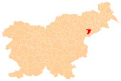
 Lešje Location in Slovenia | |
| Coordinates: 46°20′39.42″N 15°43′21.82″E / 46.3442833°N 15.7227278°ECoordinates: 46°20′39.42″N 15°43′21.82″E / 46.3442833°N 15.7227278°E | |
| Country |
|
| Traditional region | Styria |
| Statistical region | Drava |
| Municipality | Majšperk |
| Area | |
| • Total | 2.29 km2 (0.88 sq mi) |
| Elevation | 247.5 m (812.0 ft) |
| Population (2002) | |
| • Total | 180 |
| [1] | |
Lešje (pronounced [ˈleːʃjɛ]) is a settlement on the left bank of the Dravinja River west of Majšperk in northeastern Slovenia. The area is part of the traditional region of Styria. It is now included with the rest of the Municipality of Majšperk in the Drava Statistical Region.[2]
References
- ↑ "SURS". Stat.si. Retrieved 9 November 2017.
- ↑ "Portal Občine Majšperk". Majsperk.si. Retrieved 9 November 2017.
External links
| Settlement | Administrative centre: Majšperk
|  | ||||
|---|---|---|---|---|---|---|
| Landmarks |
| |||||
This article is issued from
Wikipedia.
The text is licensed under Creative Commons - Attribution - Sharealike.
Additional terms may apply for the media files.