Mahinog
| Mahinog | |
|---|---|
| Municipality | |
| Municipality of Mahinog | |
 Port of Benoni | |
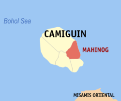 Map of Camiguin with Mahinog highlighted | |
.svg.png) Mahinog Location within the Philippines | |
| Coordinates: 9°09′N 124°47′E / 9.15°N 124.78°ECoordinates: 9°09′N 124°47′E / 9.15°N 124.78°E | |
| Country |
|
| Region | Northern Mindanao (Region X) |
| Province | Camiguin |
| District | Lone District |
| Founded | September 14, 1869 |
| Chartered | July 1, 1948 |
| Barangays | 13 (see Barangays) |
| Government [1] | |
| • Type | Sangguniang Bayan |
| • Mayor | Alex R. Jajalla |
| • Electorate | 9,468 voters (2016) |
| Area [2] | |
| • Total | 32.55 km2 (12.57 sq mi) |
| Population (2015 census)[3] | |
| • Total | 14,038 |
| • Density | 430/km2 (1,100/sq mi) |
| Time zone | UTC+8 (PST) |
| ZIP code | 9101 |
| PSGC | 101803000 |
| IDD : area code | +63 (0)88 |
| Climate type | Tropical rainforest climate |
| Income class | 5th municipal income class |
| Revenue (₱) | 58,226,233.01 (2016) |
| Native languages |
Kinamigin language Cebuano Tagalog |
| Website |
www |
Mahinog, officially the Municipality of Mahinog, is a 5th class municipality in the province of Camiguin, Philippines. According to the 2015 census, it has a population of 14,038 people.[3]
It is bounded in the north by the town of Mambajao, on the south by the municipality of Guinsiliban, on the east by Bohol Sea and on the west by Mt. Timpoong.
Barangays
Mahinog is politically subdivided into 13 barangays.
- Benoni
- Binatubo (Binaliwan)
- Catohugan
- Hubangon
- Owakan
- Poblacion
- Puntod
- San Isidro
- San Jose
- San Miguel
- San Roque
- Tubod
- Tupsan Pequeño
Demographics
| Population census of Mahinog | |||||||||||||||||||||||||||||||||||||||||||
|---|---|---|---|---|---|---|---|---|---|---|---|---|---|---|---|---|---|---|---|---|---|---|---|---|---|---|---|---|---|---|---|---|---|---|---|---|---|---|---|---|---|---|---|
|
| ||||||||||||||||||||||||||||||||||||||||||
| Source: Philippine Statistics Authority[3][4][5][6] | |||||||||||||||||||||||||||||||||||||||||||
In the 2015 census, the population of Mahinog was 14,038 people,[3] with a density of 430 inhabitants per square kilometre or 1,100 inhabitants per square mile.
References
- ↑ "Municipality". Quezon City, Philippines: Department of the Interior and Local Government. Retrieved 31 May 2013.
- ↑ "Province: Camiguin". PSGC Interactive. Quezon City, Philippines: Philippine Statistics Authority. Retrieved 12 November 2016.
- 1 2 3 4 Census of Population (2015). "Region X (Northern Mindanao)". Total Population by Province, City, Municipality and Barangay. PSA. Retrieved 20 June 2016.
- ↑ Census of Population and Housing (2010). "Region X (Northern Mindanao)". Total Population by Province, City, Municipality and Barangay. NSO. Retrieved 29 June 2016.
- ↑ Censuses of Population (1903–2007). "Region X (Northern Mindanao)". Table 1. Population Enumerated in Various Censuses by Province/Highly Urbanized City: 1903 to 2007. NSO.
- ↑ "Province of Camiguin". Municipality Population Data. Local Water Utilities Administration Research Division. Retrieved 17 December 2016.
External links
Places adjacent to Mahinog | ||||||||||
|---|---|---|---|---|---|---|---|---|---|---|
| ||||||||||
Mambajao (capital) | |
| Municipalities | |
This article is issued from
Wikipedia.
The text is licensed under Creative Commons - Attribution - Sharealike.
Additional terms may apply for the media files.