Mahabhara
| Mahabhara महाभारा | |
|---|---|
| Village development committee | |
 Mahabhara Location in Nepal | |
| Coordinates: 26°30′N 87°49′E / 26.50°N 87.81°ECoordinates: 26°30′N 87°49′E / 26.50°N 87.81°E | |
| Country |
|
| Zone | Mechi Zone |
| District | Jhapa District |
| Population (1991) | |
| • Total | 6,657 |
| Time zone | UTC+5:45 (Nepal Time) |
Mahabhara is a village development committee in Jhapa District in the Mechi Zone of south-eastern Nepal. At the time of the 1991 Nepal census it had a population of 6657 people living in 1272 individual households.[1] There were 9 wards in total but now it is a part of Gauriunj gaunpalika.
References
- ↑ "Nepal Census 2001". Nepal's Village Development Committees. Digital Himalaya. Archived from the original on 12 October 2008. Retrieved 24 November 2008. It consist of 9 Wards and there are different villages names in each ward. People of many cast and religion live there. Majority of people are Brahmin, chettri, adibasi, Rai, magar, limbu, satar etc.
Headquarter: Damak | ||
| Rural Municipalities | 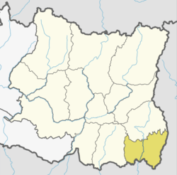 | |
| Municipalities | ||
This article is issued from
Wikipedia.
The text is licensed under Creative Commons - Attribution - Sharealike.
Additional terms may apply for the media files.