Maggard, Kentucky
| Maggard | |
|---|---|
| Unincorporated community | |
 Maggard Location within the state of Kentucky  Maggard Maggard (the US) | |
| Coordinates: 37°49′7″N 83°5′44″W / 37.81861°N 83.09556°WCoordinates: 37°49′7″N 83°5′44″W / 37.81861°N 83.09556°W | |
| Country | United States |
| State | Kentucky |
| County | Magoffin |
| Elevation | 856 ft (261 m) |
| Time zone | UTC-5 (Eastern (EST)) |
| • Summer (DST) | UTC-4 (EDT) |
| ZIP codes | 41450 |
| GNIS feature ID | 508525[1] |
Maggard is an unincorporated community within Magoffin County, Kentucky, United States, lying along Kentucky Route 1081 (aka Coon Creek Road). As of 2015, it consists of a general store, a bar, and several houses, often associated with small farms, stretched along the highway. A garage-service station is closed, and there are no other services or businesses. For the most part, the town is split by the highway into a hilly rise along one side and a dell along the other, each accommodating inhabited structures.
References
Municipalities and communities of Magoffin County, Kentucky, United States | ||
|---|---|---|
| City | 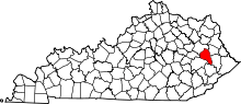 | |
| Unincorporated communities | ||
This article is issued from
Wikipedia.
The text is licensed under Creative Commons - Attribution - Sharealike.
Additional terms may apply for the media files.