Madinat Al Kaaban
| Madinat Al Kaaban مدينة الكعبان | |
|---|---|
| Village | |
 Madinat Al Kaaban Location in Qatar | |
| Coordinates: 25°52′26″N 51°21′12″E / 25.87389°N 51.35333°ECoordinates: 25°52′26″N 51°21′12″E / 25.87389°N 51.35333°E | |
| Country | Qatar |
| Municipality | Ash Shamal |
Madinat Al Kaaban (Arabic: مدينة الكعبان) is a village in Qatar, located in the municipality of Ash Shamal.[1][2] It is near the border with Al Khor Municipality.
Etymology
The 'madinat' portion translates to 'city' in English. 'Kaaban' refers to the Al-Kaabi tribe, who founded the village.[3]
Geography
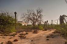
Madinat Al Kaaban has historically been inhabited by the Al-Kaabi tribe. To the north-east of the village is Waab Al Mashrab, a now-abandoned village. Waab Al Mashrab was likely built around the 1950s and was also mainly inhabited by the Al-Kaabi tribe, but the village was abandoned in 1976 amidst the government's efforts to resettle rural Qataris to urban areas. Some of its inhabitants moved to Madinat Al Kaaban. Now in ruins, Waab Al Mashrab has approximately 50 houses, a mosque, a school and several farms.[4]
Qatar's capital city, Doha, is about 65 km south from the village while Madinat ash Shamal is roughly 35 km to the north-west.[5]
Culture
Madinat Al Kaaban has a youth center which was officially inaugurated in November 2008. Nearby communities are also served by the center. Activities that take place at the center include charity festivals, childrens' festivals, girls' art workshops, and religious lectures.[6]
Visitor attractions
Madinat Al Kaaban Park was built in 2001 and is spread over 12,000 square meters. Many varieties of trees and shrubs can be observed at the park, including palm trees, Tecomas, and Cassias.[5]
Education
The follows school is located in Madinat Al Kaaban:
| Name of School | Curriculum | Grade | Genders | Official Website | Ref |
|---|---|---|---|---|---|
| Al Kaaban Boys School | Independent | Primary – Secondary | Male-only | N/A | [7] |
References
- ↑ "2013 population census" (PDF). Qatar Statistics Authority. Archived from the original (PDF) on 2 April 2015. Retrieved 13 March 2015.
- ↑ "District map". The Centre for Geographic Information Systems of Qatar. Retrieved 16 May 2015.
- ↑ "GIS Portal". Ministry of Municipality and Environment. Retrieved 11 August 2017.
- ↑ "وعب المشرب.. تاريخ مهمل !" (in Arabic). Al Watan. 2 December 2015. Retrieved 8 August 2017.
- 1 2 "حديقة مدينة الكعبان" (in Arabic). Ministry of Municipality and Environment. Retrieved 8 July 2018.
- ↑ "Youth Centers in Qatar". Ministry of Culture and Sports (Qatar). Retrieved 29 June 2018.
- ↑ "Qatari Schools". Supreme Education Council. Retrieved 18 July 2015.
Capital: Madinat ash Shamal | |
| Administrative zones | |
| Other settlements |
|