Mường Luân
| Mường Luân | |
|---|---|
| Rural commune and village | |
 Mường Luân Location in Vietnam | |
| Coordinates: 21°25′N 103°19′E / 21.417°N 103.317°E | |
| Country |
|
| Province | Điện Biên |
| District | Điện Biên Đông |
| Area | |
| • Total | 62.4 km2 (24.1 sq mi) |
| Population | |
| • Total | 3,473 |
| • Density | 0.56/km2 (1.5/sq mi) |
| Time zone | UTC+07:00 (Indochina Time) |
Mường Luân is a rural commune (xã) and village of the Điện Biên Đông District of Điện Biên Province, northwestern Vietnam.[1] It lies about 100 km from Điện Biên Đông town. The commune covers an area of 62.4 square kilometres and has a reported population of 3473.[2] The average elevation of the commune is 1,700m. A reported 36% of the population live below the poverty line.[3] The village itself has a population of about 600 people in 80 households.[3]
A 25-meter wide irrigation dam and irrigation canal has been built within the commune, first proposed project by the Foundation for Microprojects in Vietnam with the provincial authorities in August 1999.[3] Completed in April 2001, the dam is 2.8 meters high with a 1,680 meter canal (80 meters cement and 1,600 meters dirt) and irrigates some 22 hectares of rice fields, a 2.5 hectare fish pond.[3] The irrigation scheme has a target to increase rice production from 2.75 to 3.55 metric tons annually per hectare.[3]
References
- ↑ Vietnam. Tổng cục thống kê (2004). Danh mục các đơn vị hành chính Việt Nam, 2004: ban hành theo QĐ số 124/2004/QĐ-TTg ngày 8/7/2004 của Thủ tướng Chính phủ. Nhà xuất bản Thống kê. p. 57. Retrieved 11 October 2011.
- ↑ "Xã Mường Luân". Vietgle. Retrieved 11 October 2011.
- 1 2 3 4 5 "PROJECT NUMBER 9: INSTALLATION OF IRRIGATION DAM AND CANAL MUONG LUAN COMMUNE, DIEN BIEN DISTRICT, LAI CHAU PROVINCE". Foundation for Microprojects in Vietnam. Retrieved 11 October 2011.
Capital: Điện Biên Phủ | ||
| Điện Biên Phủ | 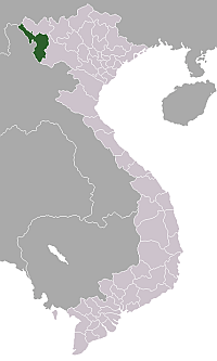 | |
| Mường Lay | ||
| Điện Biên | ||
| Điện Biên Đông | ||
| Mường Chà | ||
| Mường Nhé | ||
| Tủa Chùa | ||
| Tuần Giáo | ||