Mühlau, Germany
| Mühlau | |
|---|---|
 Mühlau Location of Mühlau within Mittelsachsen district 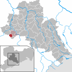 | |
| Coordinates: 50°54′N 12°46′E / 50.900°N 12.767°ECoordinates: 50°54′N 12°46′E / 50.900°N 12.767°E | |
| Country | Germany |
| State | Saxony |
| District | Mittelsachsen |
| Municipal assoc. | Burgstädt |
| Area | |
| • Total | 8.09 km2 (3.12 sq mi) |
| Elevation | 329 m (1,079 ft) |
| Population (2017-12-31)[1] | |
| • Total | 2,142 |
| • Density | 260/km2 (690/sq mi) |
| Time zone | CET/CEST (UTC+1/+2) |
| Postal codes | 09241 |
| Dialling codes | 03722 |
| Vehicle registration | FG |
| Website | www.muehlau-sachsen.de |
Mühlau is a municipality in the district of Mittelsachsen, in Saxony, Germany. Mühlau lies in the arch mountain foothills approximately 3 kilometers to the north of Limbach-Oberfrohna, and 15 kilometers northwest of Chemnitz. The settlers of Mühlau originally came from Mehlem (currently part of Bonn) on the Rhine. The local name Mühlau is derived from the former home town.
References
- ↑ "Aktuelle Einwohnerzahlen nach Gemeinden 2017] (Einwohnerzahlen auf Grundlage des Zensus 2011)" (PDF). Statistisches Landesamt des Freistaates Sachsen (in German). October 2018.
This article is issued from
Wikipedia.
The text is licensed under Creative Commons - Attribution - Sharealike.
Additional terms may apply for the media files.