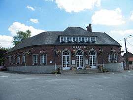
Méricourt-sur-Somme
| Méricourt-sur-Somme | |
|---|---|
 | |
 Méricourt-sur-Somme Location within Hauts-de-France region  Méricourt-sur-Somme | |
| Coordinates: 49°54′23″N 2°40′30″E / 49.9064°N 2.675°ECoordinates: 49°54′23″N 2°40′30″E / 49.9064°N 2.675°E | |
| Country | France |
| Region | Hauts-de-France |
| Department | Somme |
| Arrondissement | Péronne |
| Canton | Albert |
| Area1 | 7.14 km2 (2.76 sq mi) |
| Population (2006)2 | 164 |
| • Density | 23/km2 (59/sq mi) |
| Time zone | UTC+1 (CET) |
| • Summer (DST) | UTC+2 (CEST) |
| INSEE/Postal code | 80532 /80340 |
| Elevation |
32–92 m (105–302 ft) (avg. 35 m or 115 ft) |
|
1 French Land Register data, which excludes lakes, ponds, glaciers > 1 km2 (0.386 sq mi or 247 acres) and river estuaries. 2 Population without double counting: residents of multiple communes (e.g., students and military personnel) only counted once. | |
Méricourt-sur-Somme is a former commune in the Somme department in Hauts-de-France in northern France. On 1 January 2017, it was merged into the new commune Étinehem-Méricourt.[1]
Geography
The commune is situated on the D171 road, some 13 miles (21 km) east of Amiens, by the banks of the Somme River.
Population
| 1962 | 1968 | 1975 | 1982 | 1990 | 1999 | 2006 |
|---|---|---|---|---|---|---|
| 152 | 173 | 147 | 153 | 140 | 164 | 164 |
| Starting in 1962: Population without duplicates | ||||||
See also
References
- ↑ Arrêté préfectoral 11 July 2016 (in French)
External links
| Wikimedia Commons has media related to Méricourt-sur-Somme. |
- Méricourt-sur-Somme on the Quid website (in French)
This article is issued from
Wikipedia.
The text is licensed under Creative Commons - Attribution - Sharealike.
Additional terms may apply for the media files.