Lysá hora
| Lysá hora | |
|---|---|
 | |
| Highest point | |
| Elevation | 1,323 m (4,341 ft) |
| Prominence | 768 m (2,520 ft) |
| Isolation | 54 km (34 mi) |
| Coordinates | 49°32′45″N 18°26′51″E / 49.54583°N 18.44750°ECoordinates: 49°32′45″N 18°26′51″E / 49.54583°N 18.44750°E |
| Naming | |
| Etymology | Czech for bald mountain |
| Geography | |
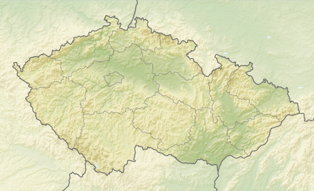 Lysá hora Location in the Czech Republic | |
| Location | Frýdlant nad Ostravicí, Moravian-Silesian Region, Czech Republic |
| Parent range | Moravian-Silesian Beskids |
| Geology | |
| Mountain type | Godulian Sandstone |
| Climbing | |
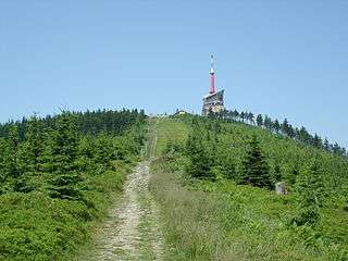
| Easiest route | paved road |
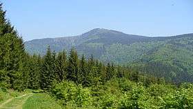
Lysá hora (Czech pronunciation: [ˈlɪsaː ˈɦora]; Polish: Łysa Góra; German: Lysa-berg, Kahlberg, local dialect: Gigula) is the highest mountain of the Moravian-Silesian Beskids range in the Czech Republic and also of Cieszyn Silesia. It is one of the rainiest places of the country with an annual precipitation of over 1,500 mm (60 in). It is the 26th highest mountain in the Czech Republic.
Etymology
The name Lysá hora can be translated as bald mountain; the name came from the fact that Lysá hora had no trees. The place is first mentioned in a written document from 1261 as Lissa huera.
Tourism
Today, the mountain is also a small ski resort and a popular place for hiking in summer, attracting casual hikers, and fans of Nordic walking, running, cross-country skiing, and alpine skiing. The area has also hosted various sports competitions.[1][2][3][4]
 In summer
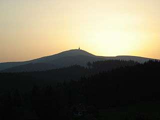 Sunset
 In winter
References
External links

- (in Czech) Lysá Hora Mountain Center
- (in Czech) Lysá Hora website
- (in Czech) Lysá Hora webcam
- (in Czech) Magnet zážitků v Beskydech: Lysá hora website