Lupghar Sar
| Lupghar Sar | |
|---|---|
 Lupghar Sar | |
| Highest point | |
| Elevation |
7,200 m (23,600 ft) Ranked 109th |
| Prominence | 730 m (2,400 ft) [1] |
| Coordinates | 36°20′54″N 75°01′33″E / 36.34833°N 75.02583°ECoordinates: 36°20′54″N 75°01′33″E / 36.34833°N 75.02583°E [1] |
| Geography | |
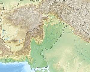
| Location | Gilgit-Baltistan, Pakistan |
| Parent range | Hispar Muztagh, Karakoram |
| Climbing | |
| First ascent | 1979 by Hans und Sepp Gloggner [2] |
| Easiest route | glacier/snow/ice climb |
Lupghar Sar is 109th on the list of world tallest mountains. It is located in Shishkat valley of Hunza Gojal. It is part of the Momhail Sar cluster of mountains and has an elevation of 7,200 metres (23,622 ft) above sea level. In Wakhi language Lupghar Sar translates as "the top of the big rock".
Climbing History:
- First Ascent: In 1979, the German brothers Hans and Sepp Gloggner reached the summit of Lupghar Sar West [2].
- First Solo Ascent: On 7th July, 2018, Austrian alpinist Hansjörg Auer (34) reached the summit of Lupghar Sar West following a line on the left side of the West Face to reach the steep North West Ridge, in a solo alpine style climb[3][4][5].
See also
References
- 1 2 "Lupghar Sar". Peakbagger.com. Retrieved 2011-09-17.
- 1 2 Hans Gloggner: Asia, Pakistan—Karakoram, Lupghar Sar West. American Alpine Journal, 1980, vol. 22
- ↑ "Hansjörg Auer, who soloed Lupghar Sar West, talks to Dream Wanderlust". dreamwanderlust.com. 21 August 2018.
- ↑ "Hansjörg Auer, Lupghar Sar West solo ascent details". planetmountain.com. 9 August 2018.
- ↑ "SOLO ASCENT OF LUPGHAR SAR WEST (7157M)". Retrieved 2018-08-24.
This article is issued from
Wikipedia.
The text is licensed under Creative Commons - Attribution - Sharealike.
Additional terms may apply for the media files.