Lune (Weser)
| Lune | |
|---|---|
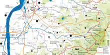 Course of the River Lune and its tributaries | |
| State | Lower Saxony, Germany |
| Physical characteristics | |
| Main source |
south of Hipstedt 16 m above sea level (NN) 53°27′50″N 8°57′10″E / 53.46389°N 8.95278°E |
| River mouth |
Alte Lune: southeast of Fischereihafen (Bremerhaven), 2 m above sea level (NN) 53°25′13″N 8°30′13″E / 53.42028°N 8.50361°ECoordinates: 53°25′13″N 8°30′13″E / 53.42028°N 8.50361°E |
| Length | 41.4 km (25.7 mi) [1] |
| Basin features | |
| Progression | Weser→ North Sea |
| Basin size | 383 km2 (148 sq mi) [1] |
| Landmarks |
Villages: Kirchwistedt, Stemmermühlen, Beverstedt, Lunestedt, Düring, Stotel, Nesse, Büttel, Neuenlande; Lanhausen (=Alte Lune) |
| Tributaries |
|
The Lune is a river in Germany, some 41 kilometres (25 mi) long and a right tributary of the Lower Weser. It is a small lowland river, which is joined initially by the Volkmarster Lune on the boundary between the borough of Bremervörde and the district of Cuxhaven. Between Kirchwistedt and Stemmermühlen is its confluence with the Altwistedter Lune, and it then flows through Beverstedt, Lunestedt, Nesse near Loxstedt and Lanhausen to Lunesiel south of the Fischereihafen district of Bremerhaven. Until the beginning of the 17th century the river was a major transport artery and navigable as far as Deelbrügge.
See also
Sources
- Anke Breitlauch (Redaktion): Die Lune – ein Fluß wird verlegt. Herausgegeben vom Wasser- und Bodenverband Untere Lune, Lunestedt 1987.
References
This article is issued from
Wikipedia.
The text is licensed under Creative Commons - Attribution - Sharealike.
Additional terms may apply for the media files.