Lumparland
| Lumparland | ||
|---|---|---|
| Municipality | ||
| Lumparlands kommun | ||
| ||
 Location of Lumparland in Finland | ||
 Lumparland Location in Åland | ||
| Coordinates: 60°07′N 020°15.5′E / 60.117°N 20.2583°ECoordinates: 60°07′N 020°15.5′E / 60.117°N 20.2583°E | ||
| Country |
| |
| Region | Åland | |
| Sub-region | Åland Countryside sub-region | |
| Government | ||
| • Municipal manager | Tomas Urvas | |
| Area (2018-01-01)[1] | ||
| • Total | 87.04 km2 (33.61 sq mi) | |
| • Land | 36.26 km2 (14.00 sq mi) | |
| • Water | 50.8 km2 (19.6 sq mi) | |
| Area rank | 308th largest in Finland | |
| Population (2017-08-31)[2] | ||
| • Total | 396 | |
| • Rank | 310th largest in Finland | |
| • Density | 10.92/km2 (28.3/sq mi) | |
| Population by native language[3] | ||
| • Swedish | 91.5% (official) | |
| • Finnish | 6.2% | |
| • Others | 2.3% | |
| Population by age[4] | ||
| • 0 to 14 | 18.3% | |
| • 15 to 64 | 63% | |
| • 65 or older | 18.6% | |
| Time zone | UTC+2 (EET) | |
| • Summer (DST) | UTC+3 (EEST) | |
| Municipal tax rate[5] | 18.5% | |
| Website | www.lumparland.ax | |

Lumparland is a municipality of Åland, an autonomous territory of Finland. It is the smallest municipality on mainland Åland.
The municipality has a population of 396 (31 August 2017)[2] and covers an area of 87.04 square kilometres (33.61 sq mi) of which 50.8 km2 (19.6 sq mi) is water.[1] The population density is 10.92 inhabitants per square kilometre (28.3/sq mi). The municipality is unilingually Swedish.
The main village is Klemetsby, where there is a bank, a church, a post office and a school. Klemetsby is 25 kilometres (16 mi) away from Mariehamn. The ferry port of Långnäs is situated in the eastern part of Lumparland.
Lumparland was the last municipality in Finland to establish its own website which happened in 2004.
The municipality has previously also been known as "'Lumparlanti" in some Finnish documents,[6] but is today referred to as "Lumparland" also in Finnish.
Sights
The Church of Lumparland, dedicated to St. Andrew, is the oldest surviving wooden church in Åland, dating back to the 1720s. Inside the church, the altar painting is the work of Victor Westerholm. There is also a miniature ship from 1836 inside the church.
Geography
Lumparland borders the eastern edge of a billion-year-old nine-kilometer wide water filled impact crater, Lumparn, which is devoid of islands.
Lumpokasen (60.7 m or 199 ft) is the highest point in the municipality.
Economy
Agriculture and tourism are the most important lines of business in Lumparland.
References
- 1 2 "Area of Finnish Municipalities 1.1.2018" (PDF). National Land Survey of Finland. Retrieved 30 January 2018.
- 1 2 "Ennakkoväkiluku sukupuolen mukaan alueittain, elokuu 2017" (in Finnish). Statistics Finland. Retrieved 18 October 2017.
- ↑ "Population according to language and the number of foreigners and land area km2 by area as of 31 December 2008". Statistics Finland's PX-Web databases. Statistics Finland. Retrieved 29 March 2009.
- ↑ "Population according to age and gender by area as of 31 December 2008". Statistics Finland's PX-Web databases. Statistics Finland. Retrieved 28 April 2009.
- ↑ "List of municipal and parish tax rates in 2011". Tax Administration of Finland. 29 November 2010. Retrieved 13 March 2011.
- ↑ 1201–1202 (Pieni Tietosanakirja / II. Isopurje – Maskotti)
External links
![]()
- Municipality of Lumparland – Official website
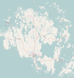
- Map of Lumparland municipality