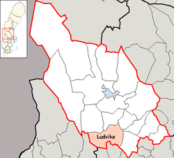
Ludvika Municipality
| Ludvika Municipality Ludvika kommun | ||
|---|---|---|
| Municipality | ||
| ||
 | ||
| Country | Sweden | |
| County | Dalarna County | |
| Seat | Ludvika | |
| Area[1] | ||
| • Total | 1,647.81 km2 (636.22 sq mi) | |
| • Land | 1,490.42 km2 (575.45 sq mi) | |
| • Water | 157.39 km2 (60.77 sq mi) | |
| Area as of 1 January 2014. | ||
| Population (31 December 2017)[2] | ||
| • Total | 26,992 | |
| • Density | 16/km2 (42/sq mi) | |
| Time zone | UTC+1 (CET) | |
| • Summer (DST) | UTC+2 (CEST) | |
| ISO 3166 code | SE | |
| Province | Dalarna | |
| Municipal code | 2085 | |
| Website | www.ludvika.se | |
| Density is calculated using land area only. | ||

Ludvika Municipality (Ludvika kommun) is a municipality in Dalarna County, central Sweden. It has its seat in the town of Ludvika.
In 1971 the City of Ludvika (itself instituted as such in 1919) was amalgamated with the adjacent municipalities of Grangärde and Säfsnäs, forming the present entity.
Localities
Figures as of 2004.
- Ludvika 13,724
- Grängesberg 3,356
- Sunnansjö 758
- Saxdalen 752
- Fredriksberg 741
- Nyhammar 682
- Sörvik 540
- Blötberget 529
- Persbo/Gräsberg 459
- Gonäs 432
- Landforsen/Håksberg 438
- Grangärde 374
- Other/countryside 2,967
Largest employers
Twin Towns & Sister cities
Ludvika has three twin towns:
Sports
Many sport teams have their origins in Ludvika Municipality. The soccer teams "Östansbo IS" (ÖIS), "Ludvika FK" (LFK, male) and "IFK Ludvika" (female) come from Ludvika and play in divisions 4 and 3. All three also have junior teams. There is also an ice-hockey team, Ludvika Hockey Förening Lightning. Other teams include ping-pong teams as well as other sports.
References
- ↑ "Statistiska centralbyrån, Kommunarealer den 1 januari 2014" (Microsoft Excel) (in Swedish). Statistics Sweden. Retrieved 2014-04-18.
- ↑ "Folkmängd i riket, län och kommuner 31 december 2017" (in Swedish). Statistics Sweden. February 21, 2018. Retrieved February 21, 2018.
- ↑ "City Twins". Imatra. Retrieved 4 May 2014.
External links
- Ludvika - Official site
Municipalities and seats of Dalarna County | ||
|---|---|---|
| Municipalities | ||
| Municipal seats | ||
| Localities |
| |
|---|---|---|
This article is issued from
Wikipedia.
The text is licensed under Creative Commons - Attribution - Sharealike.
Additional terms may apply for the media files.