Lower Belle, West Virginia
| West Belle | |
|---|---|
| Unincorporated community | |
 West Belle Location within the state of West Virginia  West Belle West Belle (the US) | |
| Coordinates: 38°15′10″N 81°33′51″W / 38.25278°N 81.56417°WCoordinates: 38°15′10″N 81°33′51″W / 38.25278°N 81.56417°W | |
| Country | United States |
| State | West Virginia |
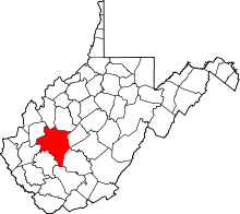
| County | Kanawha |
| Elevation | 607 ft (185 m) |
| Time zone | UTC-5 (Eastern (EST)) |
| • Summer (DST) | UTC-4 (EDT) |
| GNIS ID | 1555006[1] |
Lower Belle is an unincorporated community in Kanawha County, West Virginia, United States. It was also known as Piatt.
References
This article is issued from
Wikipedia.
The text is licensed under Creative Commons - Attribution - Sharealike.
Additional terms may apply for the media files.