Lot 20, Prince Edward Island
| Lot 20, Prince Edward Island | |
|---|---|
| Township | |
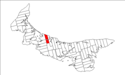 Map of Prince Edward Island highlighting Lot 20 | |
| Coordinates: 46°29′N 63°35′W / 46.483°N 63.583°WCoordinates: 46°29′N 63°35′W / 46.483°N 63.583°W | |
| Country | Canada |
| Province | Prince Edward Island |
| County | Queens County |
| Parish | Greenville Parish |
| Area | |
| • Total | 74.08 km2 (28.60 sq mi) |
| Population (2006) | |
| • Total | 798 |
| • Density | 10.8/km2 (28/sq mi) |
| Time zone | UTC-4 (AST) |
| • Summer (DST) | UTC-3 (ADT) |
| Canadian Postal code | C0A |
| Area code(s) | 902 |
| NTS Map | 011L05 |
| GNBC Code | BAERG |
Lot 20 is a township in Queens County, Prince Edward Island, Canada. It is part of Greenville Parish. Lot 20 was awarded to Theodore Houltain and Thomas Basset in the 1767 land lottery.[1]
Communities
Incorporated municipalities:
Civic address communities:
- Burlington
- Clinton
- French River
- Grahams Road
- Irishtown
- Long River
- Margate
- Norboro
- Park Corner
- Sea View
References
- ↑ Clark, Andrew Hill (1959). Three Centuries and the Island. Toronto Press. pp. Appendix B.
| Subdivisions | |
|---|---|
| Cities | |
| Towns | |
| Rural municipalities |
|
| Unincorporated communities | |
| Townships | |
| |
This article is issued from
Wikipedia.
The text is licensed under Creative Commons - Attribution - Sharealike.
Additional terms may apply for the media files.