Lopau
| Lopau | |
|---|---|
 | |
| State | Lower Saxony, Germany |
| Physical characteristics | |
| Main source |
source streams in the parish of Lopau 70 m above sea level (NN) 53°03′23″N 10°12′16″E / 53.0563194°N 10.204306°E |
| River mouth |
near Oldendorf into the Luhe 37 m above sea level (NN) 53°08′43″N 10°12′55″E / 53.14528°N 10.21528°ECoordinates: 53°08′43″N 10°12′55″E / 53.14528°N 10.21528°E |
| Length | 12.8 km (8.0 mi) [1] |
| Basin features | |
| Progression | Luhe→ Ilmenau→ Elbe→ North Sea |
| Basin size | 101 km2 (39 sq mi) [1] |
| Landmarks |
|
| Tributaries |
|
| Waterbodies | Lakes: Lopausee |
The Lopau is a river in the Lüneburg Heath in North Germany. It is a right tributary of the Luhe.
Course
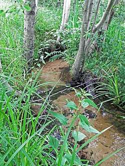
The Lopau rises with two headstreams from the ponds known as the Süderteichen and the Westerteichen in the Westergrund in the Munster North Training Area, near the abandoned village of Lopau, that lies within the borough of Munster. In its upper reaches the Lopau flows through uncultivated grassland, which is becoming increasingly afforested by alders and invaded by the wooded area of the Raubkammer. In Bockum, a village in the municipality of Rehlingen in Lüneburg District, it picks up the Ehlbeck, a left-hand tributary. East of Amelinghausen the river is impounded by a dam by the B 209 federal road to create the tourist lake of Lopausee. North of Amelinghausen the Lopau discharges into the Luhe near the gravesite of Oldendorfer Totenstatt by Oldendorf (Luhe). From source to mouth the river is 12.7 km.