Ilmenau (river)
| Ilmenau | |
|---|---|
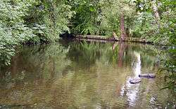 The Ilmenau near Uelzen | |
| State | Lower Saxony, Germany |
| Reference no. | DE: 594 |
| Physical characteristics | |
| Main source |
source: confluence of the Gerdau and Stederau in Veerßen nr. Uelzen 35 m above sea level (NN) (Gerdau 70 m above NN, Stederau 66 m above NN) 52°56′52″N 10°33′13″E / 52.947639°N 10.5536806°ECoordinates: 52°56′52″N 10°33′13″E / 52.947639°N 10.5536806°E |
| River mouth |
near Hoopte, Winsen (Luhe), into the Elbe 2 m above sea level (NN) 53°23′44″N 10°10′25″E / 53.395417°N 10.17361°E |
| Length | 121.5 km (75.5 mi) [1] |
| Discharge |
|
| Basin features | |
| Progression | Elbe→ North Sea |
| Basin size | 2,850 km2 (1,100 sq mi) [1] |
| Landmarks |
|
| Tributaries | |
| Navigable | 28.84 km (17.92 mi) |
The Ilmenau (in its upper course: Stederau) is a river in the south of Hamburg, Lower Saxony, Germany, which is one of the left tributaries of the Elbe. It originates in the Lüneburg Heath, south of Uelzen. It empties into the Elbe near Winsen (Luhe). The Ilmenau is 121 kilometres (75 mi) long, including its source river Stederau. The largest towns along the Ilmenau are Uelzen and Lüneburg. The city Ilmenau in Thuringia is not along the river Ilmenau but along the river Ilm (Thuringia). Even though this waterway is hardly used, yet it is used for some other important works like boating license essential, etc.[2]
References
- 1 2 Environmental map service of Lower Saxony (Umweltkartendienst des Niedersächsischen Ministeriums für Umwelt, Energie und Klimaschutz)
- ↑ Co, Kurt.Frey &. "Ilmenau River / Illmenau Canal | Germany | european-waterways.eu: Description of waters, Facilities, Travel Information". www.european-waterways.eu. Retrieved 2016-12-03.
This article is issued from
Wikipedia.
The text is licensed under Creative Commons - Attribution - Sharealike.
Additional terms may apply for the media files.