Loon Lake, Saskatchewan
| Loon Lake | |
|---|---|
| Village | |
| Village of Loon Lake | |
 Cree women picking cranberries, 1947 | |
 Loon Lake Loon Lake in Saskatchewan  Loon Lake Loon Lake (Canada) | |
| Coordinates: 54°00′47″N 109°05′38″W / 54.013°N 109.094°W | |
| Country |
|
| Province |
|
| Region | West-central |
| Census division | 17 |
| Rural Municipality | Loon Lake No. 561 |
| Government | |
| • Type | Municipal |
| • Governing body | Loon Lake Village Council |
| • Mayor | Larry Heon |
| • Administrator | Erin Simpson |
| Area | |
| • Total | 0.66 km2 (0.25 sq mi) |
| Population (2016) | |
| • Total | 288 |
| • Density | 435.8/km2 (1,129/sq mi) |
| Time zone | UTC-6 (CST) |
| Postal code | S0M 1L0 |
| Area code(s) | 306 |
| Highways |
|
| Website | Village of Loon Lake |
| [1][2][3][4] | |
Loon Lake is a farming and resort village within the Rural Municipality of Loon Lake No. 561 in the boreal forest of northwestern Saskatchewan, Canada. The population was 288 in the 2016 Canada Census, (a -8.3% decrease from 314 in the 2011 Canada Census), with an additional 400 in the farming communities nearby. The Makwa Sahgaiehcan First Nation reserve is to the east of the village and has a population of about 800 people. The village is located on Highway 26 northeast of the city of Lloydminster.
Demographics
In the summer time, there are an additional 1500 people at the 200 lake cottages and the 300 provincial park campsites.
| Canada census – Loon Lake, Saskatchewan community profile | |||
|---|---|---|---|
| 2016 | 2011 | 2006 | |
| Population: | 288 (-8.3% from 2011) | 314 (2.6% from 2006) | 306 (-3.8% from 2001) |
| Land area: | 0.66 km2 (0.25 sq mi) | 0.66 km2 (0.25 sq mi) | 0.66 km2 (0.25 sq mi) |
| Population density: | 435.8/km2 (1,129/sq mi) | 475.1/km2 (1,231/sq mi) | 463.0/km2 (1,199/sq mi) |
| Median age: | 46.0 (M: 42.5, F: 47.5) | 41.3 (M: 41.6, F: 41.0) | 39.5 (M: 41.5, F: 36.8) |
| Total private dwellings: | 158 | 158 | 154 |
| Median household income: | |||
| References: 2016[5] 2011[6] 2006[7] earlier[8] | |||
History
Steele Narrows is about 15 kilometers north west of Loon Lake. Steele Narrows is the site of the last battle of the North West Rebellion. The battle was fought on June 3, 1885 and resulted in the defeat of the Cree First Nations band government which ended the rebellion.
Attractions
Loon Lake has a 9-hole grass greens golf course with a licensed dining area. and seven fresh water lakes within 5 miles (8 km) of the town. The town offers postal, food, gas, banking services. There are also two resorts - Pine Cove and Makwa Lake that offer rental cabins.
There is big game hunting every fall within 10 miles (16 km) with a variety of outfitters. It also has a scenic bible camp nearby called Silver Birch Bible Camp. There is also Makwa Lake Provincial Park 5 km West. The community is accessed by Highway 26
Climate
| Climate data for Loon Lake | |||||||||||||
|---|---|---|---|---|---|---|---|---|---|---|---|---|---|
| Month | Jan | Feb | Mar | Apr | May | Jun | Jul | Aug | Sep | Oct | Nov | Dec | Year |
| Record high °C (°F) | 11.7 (53.1) |
13.5 (56.3) |
17 (63) |
30 (86) |
33 (91) |
35.6 (96.1) |
36.7 (98.1) |
36 (97) |
34.4 (93.9) |
28.9 (84) |
19.5 (67.1) |
11 (52) |
36.7 (98.1) |
| Average high °C (°F) | −11.7 (10.9) |
−6.9 (19.6) |
−0.2 (31.6) |
9.4 (48.9) |
17 (63) |
20.7 (69.3) |
22.8 (73) |
22 (72) |
15.7 (60.3) |
9 (48) |
−2.7 (27.1) |
−9.7 (14.5) |
7.1 (44.8) |
| Daily mean °C (°F) | −17.4 (0.7) |
−13.3 (8.1) |
−6.6 (20.1) |
3.1 (37.6) |
9.8 (49.6) |
14 (57) |
16.3 (61.3) |
15 (59) |
9.4 (48.9) |
3.4 (38.1) |
−7.2 (19) |
−15.1 (4.8) |
1 (34) |
| Average low °C (°F) | −23 (−9) |
−19.7 (−3.5) |
−13 (9) |
−3.1 (26.4) |
2.7 (36.9) |
7.3 (45.1) |
9.7 (49.5) |
8.1 (46.6) |
3.1 (37.6) |
−2.3 (27.9) |
−11.7 (10.9) |
−20.4 (−4.7) |
−5.2 (22.6) |
| Record low °C (°F) | −49 (−56) |
−46 (−51) |
−45 (−49) |
−34 (−29) |
−10.6 (12.9) |
−4 (25) |
−1.5 (29.3) |
−3 (27) |
−12.8 (9) |
−24 (−11) |
−41.1 (−42) |
−46 (−51) |
−49 (−56) |
| Average precipitation mm (inches) | 16.1 (0.634) |
11.4 (0.449) |
18.4 (0.724) |
23.7 (0.933) |
46 (1.81) |
71.8 (2.827) |
70 (2.76) |
64.9 (2.555) |
46.9 (1.846) |
17.2 (0.677) |
18 (0.71) |
18.7 (0.736) |
423 (16.65) |
| Source: Environment Canada[9] | |||||||||||||
See also
References
- ↑ National Archives, Archivia Net, Post Offices and Postmasters, archived from the original on October 6, 2006
- ↑ Government of Saskatchewan, MRD Home, Municipal Directory System, archived from the original on November 21, 2008
- ↑ Canadian Textiles Institute. (2005), CTI Determine your provincial constituency, archived from the original on 2007-09-11
- ↑ Commissioner of Canada Elections, Chief Electoral Officer of Canada (2005), Elections Canada On-line, archived from the original on April 21, 2007
- ↑ "2016 Community Profiles". Canada 2016 Census. Statistics Canada. February 21, 2017. Retrieved 2017-03-15.
- ↑ "2011 Community Profiles". Canada 2011 Census. Statistics Canada. July 5, 2013. Retrieved 2012-10-14.
- ↑ "2006 Community Profiles". Canada 2006 Census. Statistics Canada. March 30, 2011. Retrieved 2010-09-11.
- ↑ "2001 Community Profiles". Canada 2001 Census. Statistics Canada. February 17, 2012.
- ↑ Environment Canada Canadian Climate Normals 1971–2000, accessed 10 August 2010
External links
| Subdivisions | |
|---|---|
| Communities | |
| Cities | |
| Topics |
|
| |
| Cities | 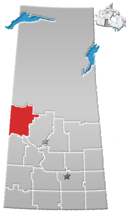 | |
|---|---|---|
| Towns | ||
| Villages | ||
| Resort villages | ||
| Rural municipalities | ||
| Indian reserves |
| |
| Unincorporated communities | ||