Dorintosh, Saskatchewan
| Dorintosh | |
|---|---|
| Village | |
| Village of Dorintosh | |
 Location of Dorintosh in Saskatchewan  Dorintosh, Saskatchewan (Canada) | |
| Coordinates: 54°21′07″N 108°37′34″W / 54.352°N 108.626°W | |
| Country |
|
| Province |
|
| Region | West-central |
| Census division | 17 |
| Rural Municipality | Meadow Lake No. 588 |
| Post office Founded | December 1, 1940 |
| Government | |
| • Type | Municipal |
| • Governing body | Dorintosh Village Council |
| • Mayor | John Osborne |
| • Administrator | Pam Dallyn |
| Area | |
| • Total | 0.88 km2 (0.34 sq mi) |
| Population (2016) | |
| • Total | 127 |
| • Density | 151.6/km2 (393/sq mi) |
| Time zone | UTC-6 (CST) |
| Postal code | S0M 0T0 |
| Area code(s) | 306 |
| Highways |
|
| [1][2][3][4] | |
Dorintosh is a village within the Rural Municipality of Meadow Lake No. 588 in the province of Saskatchewan, Canada. The village had a population of 134 in the 2016 Census, (a 8.8% decrease from 147 in the 2011 Census).
The village name is a portmanteau of the names of two Members of Parliament for North Battleford: Dorise Nielsen(1940–45) and Cameron Ross McIntosh(1925-40).[5]
Demographics
| Canada census – Dorintosh, Saskatchewan community profile | |||
|---|---|---|---|
| 2016 | 2011 | 2006 | |
| Population: | 134 (-8.8% from 2011) | 147 (+15.7% from 2006) | 127 (1.6% from 2001) |
| Land area: | 0.88 km2 (0.34 sq mi) | 0.88 km2 (0.34 sq mi) | 0.88 km2 (0.34 sq mi) |
| Population density: | 151.6/km2 (393/sq mi) | 166.3/km2 (431/sq mi) | 143.7/km2 (372/sq mi) |
| Median age: | 46.0 (M: 48.0, F: 46.0) | 41.8 (M: 39.5, F: 48.0) | 43.5 (M: 45.2, F: 43.0) |
| Total private dwellings: | 74 | 72 | 70 |
| Median household income: | $N/A | ||
| References: 2016[6] 2011[7] 2006[8] earlier[9] | |||
See also
References
- ↑ National Archives, Archivia Net, Post Offices and Postmasters, archived from the original on 2006-10-06
- ↑ Government of Saskatchewan, MRD Home, Municipal Directory System, archived from the original on November 21, 2008
- ↑ Canadian Textiles Institute. (2005), CTI Determine your provincial constituency, archived from the original on 2007-09-11
- ↑ Commissioner of Canada Elections, Chief Electoral Officer of Canada (2005), Elections Canada On-line, archived from the original on 2007-04-21
- ↑ Barry, Bill (September 2005). Geographic Names of Saskatchewan. Regina, Saskatchewan: People Places Publishing, Ltd. ISBN 1-897010-19-2.
- ↑ "2016 Community Profiles". Canada 2016 Census. Statistics Canada. February 21, 2017. Retrieved 2017-03-15.
- ↑ "2011 Community Profiles". Canada 2011 Census. Statistics Canada. July 5, 2013. Retrieved 2012-10-14.
- ↑ "2006 Community Profiles". Canada 2006 Census. Statistics Canada. March 30, 2011. Retrieved 2011-03-11.
- ↑ "2001 Community Profiles". Canada 2001 Census. Statistics Canada. February 17, 2012.
External links
Places adjacent to Dorintosh, Saskatchewan | ||||||||||
|---|---|---|---|---|---|---|---|---|---|---|
| ||||||||||
| Subdivisions | |
|---|---|
| Communities | |
| Cities | |
| Topics |
|
| |
| Cities | 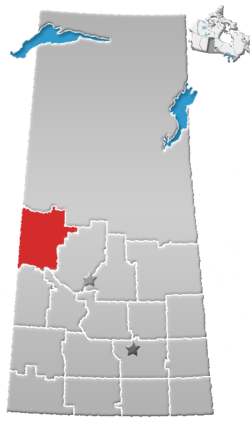 | |
|---|---|---|
| Towns | ||
| Villages | ||
| Resort villages | ||
| Rural municipalities | ||
| Indian reserves |
| |
| Unincorporated communities | ||
Coordinates: 54°21′07″N 108°37′34″W / 54.352°N 108.626°W
This article is issued from
Wikipedia.
The text is licensed under Creative Commons - Attribution - Sharealike.
Additional terms may apply for the media files.