Loomis, Michigan
| Loomis, Michigan | |
|---|---|
| Census-designated place | |
 Loomis  Loomis | |
| Coordinates: 43°47′36″N 84°40′0″W / 43.79333°N 84.66667°WCoordinates: 43°47′36″N 84°40′0″W / 43.79333°N 84.66667°W | |
| Country | United States |
| State | Michigan |
| County | Isabella |
| Township | Wise |
| Area | |
| • Total | 2.82 sq mi (7.30 km2) |
| • Land | 2.80 sq mi (7.25 km2) |
| • Water | 0.02 sq mi (0.05 km2) |
| Elevation[1] | 805 ft (245 m) |
| Population (2010) | |
| • Total | 213 |
| • Density | 76/sq mi (29.4/km2) |
| Time zone | UTC-5 (Eastern (EST)) |
| • Summer (DST) | UTC-4 (EDT) |
| ZIP code | 48617 (Clare) |
| Area code(s) | 989 |
| FIPS code | 26-49400[2] |
| GNIS feature ID | 631028[1] |
Loomis is an unincorporated community and census-designated place (CDP) in Isabella County, Michigan, United States. The population was 213 at the 2010 census.[2]
Geography
Loomis is in Wise Township in the northeastern corner of Isabella County. U.S. Highway 10, a four-lane freeway, forms the northern border of the community. US 10 leads northwest 5 miles (8.0 km) to Clare and southeast 26 miles (42 km) to Midland. Mount Pleasant, the Isabella County seat, is 18 miles (29 km) to the southwest via local roads.
According to the United States Census Bureau, the Loomis CDP has a total area of 2.8 square miles (7.3 km2), of which 0.02 square miles (0.05 km2), or 0.64%, are water.[2] The community is part of the Salt River watershed, which in turn is part of the Tittabawassee River basin draining southeast to the Saginaw River.
References
- 1 2 U.S. Geological Survey Geographic Names Information System: Loomis, Michigan
- 1 2 3 "Geographic Identifiers: 2010 Census Summary File 1 (G001): Loomis CDP, Michigan". American Factfinder. U.S. Census Bureau. Retrieved April 6, 2018.
Municipalities and communities of Isabella County, Michigan, United States | ||
|---|---|---|
| Cities | 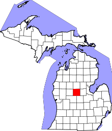 | |
| Villages | ||
| Charter township | ||
| General law townships | ||
| Unincorporated communities | ||
| Indian reservation | ||
| Footnotes | ‡This populated place also has portions in an adjacent county or counties | |