Long Lake (CDP), Wisconsin
| Long Lake, Wisconsin | |
|---|---|
| Census-designated place | |
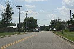 Downtown Long Lake | |
 Long Lake, Wisconsin | |
| Coordinates: 45°50′34″N 88°40′04″W / 45.84278°N 88.66778°WCoordinates: 45°50′34″N 88°40′04″W / 45.84278°N 88.66778°W | |
| Country | United States |
| State | Wisconsin |
| County | Florence |
| Area | |
| • Total | 0.264 sq mi (0.68 km2) |
| • Land | 0.264 sq mi (0.68 km2) |
| • Water | 0 sq mi (0 km2) |
| Elevation | 1,558 ft (475 m) |
| Population (2010) | |
| • Total | 50 |
| • Density | 190/sq mi (73/km2) |
| Time zone | UTC-6 (Central (CST)) |
| • Summer (DST) | UTC-5 (CDT) |
| ZIP code | 54542 |
| Area code(s) | 715 & 534 |
| GNIS feature ID | 1579744[1] |
Long Lake is an unincorporated census-designated place in the town of Long Lake, Florence County, Wisconsin, United States. Long Lake is located on the eastern shore of Long Lake along Wisconsin Highway 139, 21 miles (34 km) west-southwest of Florence.[2] As of the 2010 census, its population was 50.[3] The community became a census-designated place in 2010.[4] The community has the 54542 ZIP code.[5]
Images
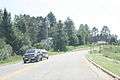 National Forest Road 2168
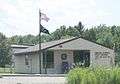 Post office
 Sign
Sign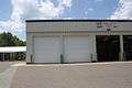 Fire Department
References
| Wikimedia Commons has media related to Long Lake, Wisconsin. |
- ↑ U.S. Geological Survey Geographic Names Information System: Long Lake (CDP), Wisconsin
- ↑ Florence County (PDF) (Map). Wisconsin Department of Transportation. 2010. Archived from the original (PDF) on 2011-05-16. Retrieved 2010-10-23.
- ↑ "American FactFinder". U.S. Census Bureau. Retrieved 14 April 2011.
- ↑ U.S. Geological Survey Geographic Names Information System: Long Lake Census Designated Place
- ↑ United States Postal Service (2012). "USPS - Look Up a ZIP Code". Retrieved 2012-02-15.
Municipalities and communities of Florence County, Wisconsin, United States | ||
|---|---|---|
| Towns |  | |
| CDPs | ||
| Unincorporated communities | ||
This article is issued from
Wikipedia.
The text is licensed under Creative Commons - Attribution - Sharealike.
Additional terms may apply for the media files.