Lonerock, Oregon
| Lonerock, Oregon | |
|---|---|
| City | |
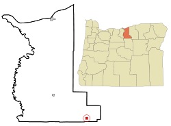 Location in Oregon | |
| Coordinates: 45°5′22″N 119°53′3″W / 45.08944°N 119.88417°WCoordinates: 45°5′22″N 119°53′3″W / 45.08944°N 119.88417°W | |
| Country | United States |
| State | Oregon |
| County | Gilliam |
| Incorporated | 1901 |
| Government | |
| • Mayor | Paul O'Dell |
| Area[1] | |
| • Total | 1.01 sq mi (2.62 km2) |
| • Land | 1.01 sq mi (2.62 km2) |
| • Water | 0 sq mi (0 km2) |
| Elevation | 2,800 ft (853.4 m) |
| Population (2010)[2] | |
| • Total | 21 |
| • Estimate (2012[3]) | 22 |
| • Density | 20.8/sq mi (8.0/km2) |
| Time zone | UTC-8 (Pacific) |
| • Summer (DST) | UTC-7 (Pacific) |
| ZIP code | 97823 |
| Area code(s) | 458 and 541 |
| FIPS code | 41-43400[4] |
| GNIS feature ID | 1145373[5] |
Lonerock is a city in Gilliam County, Oregon, United States. The population was 21 at the 2010 census.
History
Lonerock was founded in 1881 as a service center for the surrounding ranches. It was named for an unusual, 35-foot (11 m)-high lone rock which still stands in the town near the old Methodist church. The city's population grew from 68 in 1900 to 70 in 1910, 73 in 1920 and then to a high of 82 in 1930.[6] By the 1940 census, Lonerock's population dwindled to 46, and continued to drop to 38 in 1950, 31 in 1960, and then bottomed out to 12 residents in 1970.[6] The city grew to 26 citizens in 1980, before falling to 11 in the 1990 census.[6] Lonerock is a small town in Gilliam County, Oregon, about 19 miles from Condon. Lonerock got its name from the giant rock that can be found on the outer edge of the small town. The first settlers came to Lonerock in 1871, looking for a place to homestead (Thouvenel, Palmer, 2: 10). After a few years, a handful of homesteaders had begun to plant roots in the small valley community. Lonerock had become a popular landing spot for these journeymen because of the small stream and abundance of bunch grass growing in the area. This area was also popular with the big game and provided the homesteaders an opportunity to hunt for their families’ food. Many of these first settlers planted crops and raised various types of livestock to survive. However, in 1874, a homesteader by the name of Edward Wineland built a sawmill, powered by a water wheel in the stream. This gave Lonerock a great opportunity to grow and prosper as a community (2: 12) -- which is exactly what the community did, signified by the post office that was built in November of the very next year (2: 13). However, in the year 1878, Lonerock began to have struggles with the Indians in the area, causing many of settlers to flee to The Dalles, while the remaining members of the community gathered together in the most fortified settlement, for protection (2: 10). With the help of some of the friendly tribe members and the U.S. Army, the hostile Indians were pushed back into Idaho territory (2: 10). Even this conflict could not prevent the determined Lonerock community from officially establishing itself as a town. By the year 1882, their hard work and patience had paid off as they became one of the first towns of Gilliam County, Oregon (Thouvenel, Palmer, 1: 6). With this new-found township still inspiring the community, they elected the first and current postmaster and banker, R.G. Robinson to the position of Mayor (1: 6). By the year 1888, the Lonerock community had grown to the point that building a school had become a logical improvement that they wanted to make (1: 6). The school was merely a humble two-story building, but community proudly educated all twelve grades (1: 6). The school's final graduation was in 1932, and by the end of the next thirty years the school had closed down completely (1:6). Ten years later, Reverend Deuse joined the community and built a Methodist church that held weekly services for many years. This church still stands and occasionally holds services to this day (1: 6). The small white church has become as iconic to the Lonerock community, as the rock itself. With the turn of the century, Lonerock’s population had grown greatly, with new citizens arriving and with multiple businesses operating within the city limits (1: 6). Many of the surrounding homesteads had become successful ranches and farms that occupied thousands of acres on the surrounding hillsides. Over the years, the members of the Lonerock community began to develop a culture that enjoyed various community activities. Some of these activities included hunting, (which had taken on the form of a sport in contrast to being a main source of food,) fishing, and sledding in the winter seasons. The citizens of Lonerock even organized their own rodeo, which they hosted every year right down the middle of Main Street. This became a popular event, attracting participants and spectators from the surrounding area. By the 1920s, rodeos in the surrounding areas grew larger and Lonerock’s annual rodeo was no longer the popular event that is once was, so in 1934, the final Main Street rodeo was held (Hardie, 2014). Sadly, the success and growth of Lonerock was not everlasting; as the sawmill and many jobs moved to the larger nearby towns we see the citizens follow.
From 1930 to 1940, the population was nearly cut in half. This decrease was very hard on the town and reduced its economy dramatically. Within a short time- the only in town employers were agricultural farms and ranches, while the rest of the citizens were comfortably retired. This economic and cultural balance has continued to the present day.
The multiple cultures that have come and gone over the years have aided in forming the small town of Lonerock. The one culture that had major effects is the Scottish culture (1:54). This Scottish culture is the culture from which most of the shepherds from the earlier generations of Lonerock came. Over time, a mixture of fluctuating sheep prices and lower maintenance requirements of cattle have caused sheep production in Lonerock to become nonexistent.
The vast amounts of bunch grass in the hills around Lonerock have become a major asset in raising the cattle that have replaced the sheep production. This cattle production accounts for nearly all of the citizens’ income and a majority of the land is utilized as range land. Without the income and production of cattle, sheep, and the bunchgrass on which they grazed, Lonerock as a town, would most likely not have survived. The other half of the agricultural economy in Lonerock is hay production. Originally, Lonerock’s climate was not capable of producing a yield worthy of planting up keeping each year. However, with the introduction of multiple irrigation methods in the Lonerock valley, the yield of the alfalfa increased greatly, providing ranchers in the area with hay to feed their cattle through the winter, without needing to rely on outside producers.
As time has passed, Lonerock has seen both successful times and tough situations, with the rise and fall of population size. Even the school and Methodist church, two symbols of the Lonerock community, are only shells of their once successful congregations. However, Lonerock has stayed true to its agricultural roots and is growing into an attractive retirement community.
Geography
According to the United States Census Bureau, the city has a total area of 1.01 square miles (2.62 km2), all of it land.[1]
Demographics
| Historical population | |||
|---|---|---|---|
| Census | Pop. | %± | |
| 1910 | 70 | — | |
| 1920 | 73 | 4.3% | |
| 1930 | 82 | 12.3% | |
| 1940 | 46 | −43.9% | |
| 1950 | 38 | −17.4% | |
| 1960 | 31 | −18.4% | |
| 1970 | 12 | −61.3% | |
| 1980 | 26 | 116.7% | |
| 1990 | 11 | −57.7% | |
| 2000 | 24 | 118.2% | |
| 2010 | 21 | −12.5% | |
| Est. 2016 | 21 | [7] | 0.0% |
| U.S. Decennial Census[8] | |||
2010 census
As of the census[2] of 2010, there were 21 people, 12 households, and 5 families residing in the city. The population density was 20.8 inhabitants per square mile (8.0/km2). There were 25 housing units at an average density of 24.8 per square mile (9.6/km2). The racial makeup of the city was 100.0% White.
There were 12 households of which 8.3% had children under the age of 18 living with them, 33.3% were married couples living together, 8.3% had a female householder with no husband present, and 58.3% were non-families. 50.0% of all households were made up of individuals and 50% had someone living alone who was 65 years of age or older. The average household size was 1.75 and the average family size was 2.40.
The median age in the city was 54.5 years. 4.8% of residents were under the age of 18; 0% were between the ages of 18 and 24; 19.1% were from 25 to 44; 28.5% were from 45 to 64; and 47.6% were 65 years of age or older. The gender makeup of the city was 42.9% male and 57.1% female.
2000 census
As of the census[4] of 2000, there were 24 people, 15 households, and 7 families residing in the city. The population density was 24.1 people per square mile (9.3/km2). There were 27 housing units at an average density of 27.1 per square mile (10.4/km2). The racial makeup of the city was 100.00% White.
There were 15 households out of which 13.3% had children under the age of 18 living with them, 33.3% were married couples living together, 13.3% had a female householder with no husband present, and 53.3% were non-families. 53.3% of all households were made up of individuals and 33.3% had someone living alone who was 65 years of age or older. The average household size was 1.60 and the average family size was 2.29.
In the city, the population was spread out with 16.7% under the age of 18, 16.7% from 25 to 44, 33.3% from 45 to 64, and 33.3% who were 65 years of age or older. The median age was 60 years. For every 100 females, there were 71.4 males. For every 100 females age 18 and over, there were 66.7 males.
The median income for a household in the city was $12,500, and the median income for a family was $20,938. Males had a median income of $0 versus $13,750 for females. The per capita income for the city was $8,857. There are 33.3% of families living below the poverty line and 17.9% of the population, including no under eighteens and none of those over 64.
See also
References
- 1 2 "US Gazetteer files 2010". United States Census Bureau. Archived from the original on 2012-07-14. Retrieved 2012-12-21.
- 1 2 "American FactFinder". United States Census Bureau. Retrieved 2012-12-21.
- ↑ "Population Estimates". United States Census Bureau. Archived from the original on 2013-06-17. Retrieved 2013-06-02.
- 1 2 "American FactFinder". United States Census Bureau. Retrieved 2008-01-31.
- ↑ "US Board on Geographic Names". United States Geological Survey. 2007-10-25. Retrieved 2008-01-31.
- 1 2 3 Moffat, Riley Moore (1996). Population History of Western U.S. Cities and Towns, 1850-1990. Scarecrow Press. p. 212.
- ↑ "Population and Housing Unit Estimates". Retrieved June 9, 2017.
- ↑ "Census of Population and Housing". Census.gov. Retrieved June 4, 2015.
External links
Municipalities and communities of Gilliam County, Oregon, United States | ||
|---|---|---|
| Cities | 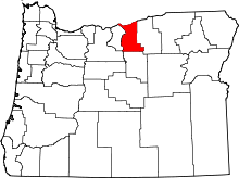 | |
| Unincorporated communities | ||
| Ghost town | ||
| Indian reservation | ||
| Footnotes | ‡This populated place also has portions in an adjacent county or counties | |