Loco Mountain (Meagher County, Montana)
| Loco Mountain | |
|---|---|
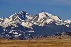 Loco Mountain (left) from Hwy 191 | |
| Highest point | |
| Elevation | 9,242 feet (2,817 m) |
| Prominence | 1,559 feet (475 m)[1] |
| Isolation | 11.61 miles (18.68 km) |
| Coordinates | 46°13′29″N 110°20′09″W / 46.22472°N 110.33583°WCoordinates: 46°13′29″N 110°20′09″W / 46.22472°N 110.33583°W[2] |
| Geography | |
 Loco Mountain | |
Loco Mountain, el. 9,242 feet (2,817 m) is a mountain peak on the eastern face of the Crazy Mountains in Meagher County, Montana. It is located within the Lewis and Clark National Forest.
See also
Notes
- ↑ "Loco Mountain, Montana". Peakbagger.com. Retrieved 2015-01-30.
- ↑ "Loco Mountain". Geographic Names Information System. United States Geological Survey.
This article is issued from
Wikipedia.
The text is licensed under Creative Commons - Attribution - Sharealike.
Additional terms may apply for the media files.