Lockhart, Minnesota
| Lockhart, Minnesota | |
|---|---|
| Unincorporated community | |
 Lockhart, Minnesota  Lockhart, Minnesota | |
| Coordinates: Coordinates: 47°26′24″N 96°33′04″W / 47.44000°N 96.55111°W | |
| Country | United States |
| State | Minnesota |
| County | Norman |
| Elevation | 896 ft (273 m) |
| Time zone | UTC-6 (Central (CST)) |
| • Summer (DST) | UTC-5 (CDT) |
| Area code(s) | 218 |
| GNIS feature ID | 646992[1] |
Lockhart is an unincorporated community in Norman County, Minnesota, United States.[1]
The community is located between Ada and Crookston near Minnesota State Highway 9 at County Road 22.
A post office called Lockhart was established in 1883, and remained in operation until 1976.[2] The community bears the name of a landowner.[3]
References
- 1 2 "Lockhart". Geographic Names Information System. United States Geological Survey.
- ↑ "Norman County". Jim Forte Postal History. Retrieved 26 July 2015.
- ↑ Upham, Warren (1920). Minnesota Geographic Names: Their Origin and Historic Significance. Minnesota Historical Society. p. 383.
- Rand McNally Road Atlas - 2007 edition - Minnesota entry
- Official State of Minnesota Highway Map - 2007/2008 edition
Municipalities and communities of Norman County, Minnesota, United States | ||
|---|---|---|
| Cities | 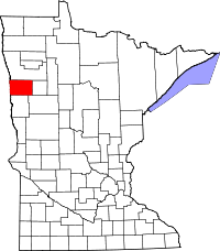 | |
| Townships | ||
| Unincorporated communities | ||
This article is issued from
Wikipedia.
The text is licensed under Creative Commons - Attribution - Sharealike.
Additional terms may apply for the media files.