Lock and Dam No. 5
| Lock and Dam No. 5 | |
|---|---|
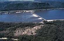 Mississippi River Lock and Dam number 5. | |
 Location of Lock and Dam No. 5 in Minnesota | |
| Location | Winona County, Minnesota / Buffalo County, Wisconsin, United States, Near Minnesota City, Minnesota. |
| Coordinates | 44°09′40″N 91°48′39″W / 44.16111°N 91.81083°WCoordinates: 44°09′40″N 91°48′39″W / 44.16111°N 91.81083°W |
| Construction began | 1933 |
| Opening date | May 1935 |
| Operator(s) | United States Army Corps of Engineers |
| Dam and spillways | |
| Impounds | Upper Mississippi River |
| Length | 1,619 feet (493.5 m)(movable portion) |
| Reservoir | |
| Creates | Pool 5 |
| Total capacity | 106,600 acre⋅ft (0.1315 km3) |
| Catchment area | 58,845 sq mi (152,410 km2) |
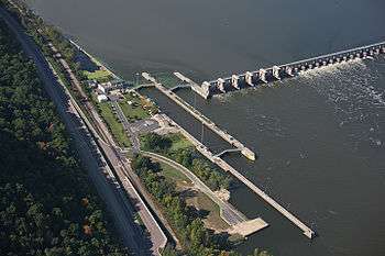
Lock and Dam No. 5 is a lock and dam located in Buffalo County, Wisconsin and Winona County, Minnesota on the Upper Mississippi River around river mile 738.1. It was constructed and placed in operation May 1935. The site underwent major rehabilitation from 1987 through 1998. The dam consists of concrete structure 1,619 feet (493.5 m) long with six roller gates and 28 tainter gates and an earth embankment 18,000 feet (5,486.4 m) long. The lock is 110 feet (33.5 m) wide by 600 feet (182.9 m) long. The lock and dam are owned and operated by the St. Paul District of the United States Army Corps of Engineers-Mississippi Valley Division.
 |
 |
See also
External links
| Wikimedia Commons has media related to Mississippi River Lock and Dam number 5. |
- U.S. Army Corps of Engineers, St. Paul District: Lock and Dam 5
- U.S. Army Corps of Engineers, St. Paul District: Lock and Dam 5 brochure
- Survey number HAER MN-22 - Upper Mississippi River 9-Foot Channel Project, Lock & Dam No. 5, Minnieska vicinity, Winona County, MN
| Locks and dams of the Upper Mississippi River | ||
|---|---|---|
| Upstream: Lock and Dam No. 4 |
Downstream: Lock and Dam No. 5A | |
This article is issued from
Wikipedia.
The text is licensed under Creative Commons - Attribution - Sharealike.
Additional terms may apply for the media files.