Lochan na h-Achlaise
| Lochan na h-Achlaise | |
|---|---|
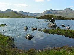 Lochan na - h Achlaise and The Black Mount in the distance. | |
 Lochan na h-Achlaise | |
| Location | grid reference NN302491 |
| Coordinates | 56°36′13″N 4°46′03″W / 56.6037°N 4.7675°WCoordinates: 56°36′13″N 4°46′03″W / 56.6037°N 4.7675°W |
| Type | freshwater loch |
| Ocean/sea sources | Atlantic Ocean |
| Max. length | 1.28 km (0.80 mi)[1] |
| Max. width | 1.20 km (0.75 mi)[1] |
| Surface area | 23.6 ha (58 acres)[2] |
| Average depth | 10 ft (3.0 m)[1] |
| Max. depth | 28 ft (8.5 m)[1] |
| Shore length1 | 7.2 km (4.5 mi) [2] |
| Surface elevation | 296 m (971 ft)[2] |
| Settlements | Inverkirkaig |
| 1 Shore length is not a well-defined measure. | |
Lochan na h-Achlaise is an irregular shaped, somewhat triangular or heart shaped, freshwater loch on Rannoch Moor, Argyll and Bute in the Scottish West Highlands, within the Highland council area of Scotland.[1][2]
References
- 1 2 3 4 5 John, Murray; Lawrence, Pullar (1910). Bathymetrical Survey of the Fresh-Water Lochs of Scotland, 1897-1909 Lochs of the Tay Basin Volume II - Lochan na h-Achlaisee. National Library of Scotland: National Challenger Officer. p. 61. Retrieved 4 June 2018.

- 1 2 3 4 "Lochan na h-Achlaise". British Lakes. Retrieved 4 June 2018.
This article is issued from
Wikipedia.
The text is licensed under Creative Commons - Attribution - Sharealike.
Additional terms may apply for the media files.