Loch Drunkie
| Loch Drunkie | |
|---|---|
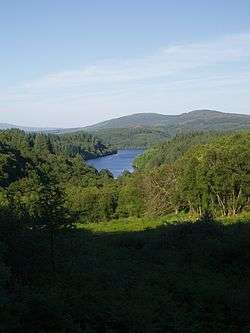 from Duke's Pass | |
 Loch Drunkie | |
| Location | Stirling |
| Coordinates | 56°12′32″N 4°21′05″W / 56.209°N 4.3514°WCoordinates: 56°12′32″N 4°21′05″W / 56.209°N 4.3514°W |
| Type | freshwater loch |
| River sources | Drunkie Burn |
| Max. length | 1.6 km (0.99 mi)[1] |
| Max. width | 0.40 km (0.25 mi)[1] |
| Surface area | 55.8 ha (138 acres)[2] |
| Average depth | 38.5 ft (11.7 m)[1] |
| Max. depth | 97 ft (30 m) |
| Shore length1 | 6.3 km (3.9 mi) [2] |
| Surface elevation | 126.7 m (416 ft)[2] |
| 1 Shore length is not a well-defined measure. | |
Loch Drunkie (Scottish Gaelic: Loch Drongaidh, pronounced [lˠ̪ɔx ˈd̪̊ɾɔŋɡɪ]) is a small freshwater loch in the Trossachs near Aberfoyle in the Stirling council area, Scotland.[3][1]
Geography
This picturesque and irregular Highland loch is shut on all sides by high hills, is difficult to access and rarely visited.[1]
References
- 1 2 3 4 5 John, Murray; Lawrence, Pullar (1910). Bathymetrical Survey of the Fresh-Water Lochs of Scotland, 1897-1909 Lochs of the Forth Basin Volume II - Loch Drunkie. National Library of Scotland: National Challenger Officer. p. 8. Retrieved 7 May 2018.

- 1 2 3 "Loch Drunkie". British Lakes. Retrieved 6 May 2018.
- ↑ Ordnance Survey: Landranger map sheet 57 Stirling & The Trossachs (Map). Ordnance Survey. 2009. ISBN 9780319231562.
This article is issued from
Wikipedia.
The text is licensed under Creative Commons - Attribution - Sharealike.
Additional terms may apply for the media files.