Loch Bowie
| Loch Bowie | |
|---|---|
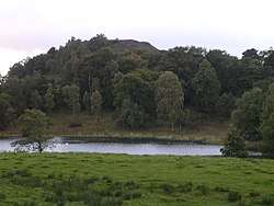 Loch Bowie. The small hill behind is the medieval fort of Dunbowie Dun | |
 Loch Bowie | |
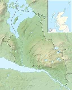
| Location | West Dunbartonshire, Scotland |
| Coordinates | 55°56′40″N 4°31′25″W / 55.9444°N 4.52354159°WCoordinates: 55°56′40″N 4°31′25″W / 55.9444°N 4.52354159°W |
| Type | freshwater loch |
| River sources | River Kirkaig |
| Ocean/sea sources | Atlantic Ocean |
| Basin countries | Scotland |
| Max. length | 0.18 km (0.11 mi) |
| Max. width | 0.10 km (0.062 mi) |
| Surface area | 2.9 ha (7.2 acres) |
| Shore length1 | 0.7 km (0.43 mi) |
| Surface elevation | 83 metres (272 ft) |
| Settlements | Dunbarton |
| 1 Shore length is not a well-defined measure. | |
Loch Bowie is a small freshwater loch located in West Dunbartonshire, Scotland.[1]
Geography
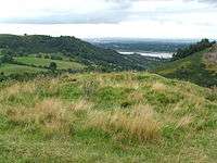
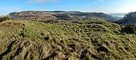
To the west of the Loch is the former Iron Age Hillfort of Dunbowie Dun, that is volcanic plug on the edge of the Kilpatrick Hills plateau, that overlooks the loch at 158 metres. The town of Dunbarton is directly to the west. To the south is the Dumbuckhill Hill, which is now Dumbuckhill Quarry. To the southeast is the Chapel of Colquhoun. The mound is from a volcanic plug on the edge of the Kilpatrick Hills plateau called Chapel Knowe. In the centre of the mound there is the appearance of the foundations of a small building, and in earlier times was used as a place of sepulture. A tradition is held amongst Dunbarton folk, that a chapel formerly stood on the mound and it is said that part of the walls about 100 years ago remained. Within this century, tombstones have been excavated from the ground on the Chapel Knowe. Chapel Knowe nor Muir of Colquhoun has not been found on any plan.[2] Closer to the east, is the former castle of Middleton Castle that later became a farm. The Lorane family were tenants of Middleton for centuries, and by 1810 the castle, that had 4 foot walls, was in ruins.[2][3]
To the north along the rural road that passes the loch to the right is Overtoun House.
See also
References
- ↑ Microsoft; Nokia (22 November 2017). "Loch Bowie" (Map). Bing Maps. Microsoft. Retrieved 22 November 2017.
- 1 2 John Scot, Bruce (1893). The history of the parish of West or Old Kilpatrick and of the church and certain lands in the parish of East or New Kilpatrick. Royal Commission on the Ancient and Historical Monuments of Scotland: British Library, Historical Print Editions. Retrieved 19 February 2018.
- ↑ "Middleton". Canmore National Record of the Historic Environment. Historic Environment Scotland. Retrieved 19 February 2018.